LED Online Seminar 2018 - Working Group 12: Difference between revisions
| (144 intermediate revisions by 6 users not shown) | |||
| Line 17: | Line 17: | ||
<gallery caption=" " widths="150px" heights="150px" perrow="5"> | <gallery caption=" " widths="150px" heights="150px" perrow="5"> | ||
File:Manifesto SusannaPatata.jpg|Susanna | File:Manifesto SusannaPatata.jpg|Susanna's manifesto | ||
File:The island Utopia by Thomas More (1516).jpg|Rouhollah's manifesto | File:The island Utopia by Thomas More (1516).jpg|Rouhollah's manifesto | ||
File:Petar Jurički Manifesto.jpg|Petar's manifesto | File:Petar Jurički Manifesto.jpg|Petar's manifesto | ||
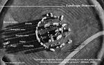
File: | File:Manifesto Of landscpa edemocracy.jpg|Mahsa's Manifesto | ||
File: Landscape manifesto - Brussels one of the most democratic landscape city in the world.png|Eric's manifesto | File: Landscape manifesto - Brussels one of the most democratic landscape city in the world.png|Eric's manifesto | ||
</gallery> | </gallery> | ||
| Line 66: | Line 65: | ||
Goldstein, B. E., A. T. Wessells, R. Lejano, and W. Butler. 2015. Narrating Resilience: Transforming Urban Systems Through Collaborative Storytelling. Urban Studies. 52 (7): 1285-1303. Eric Vitrier | Goldstein, B. E., A. T. Wessells, R. Lejano, and W. Butler. 2015. Narrating Resilience: Transforming Urban Systems Through Collaborative Storytelling. Urban Studies. 52 (7): 1285-1303. Eric Vitrier | ||
'Reading the Landscape' by Simon Bell, EMU Tartu - R.Rahimi | |||
=== Steps 3 and 4: Concepts Selection and definition === | === Steps 3 and 4: Concepts Selection and definition === | ||
| Line 75: | Line 75: | ||
'''Concepts and definitions''' | '''Concepts and definitions''' | ||
'''Author 1: | '''Author 1: Susanna Patata''' | ||
*...... | *Concept 1: The New Urban Agenda was adopted at the United Nations Conference on Housing and Sustainable Urban Development (Habitat III) in Quito on 2016. Represents a shared vision for a better and more sustainable future where everybody have equal rights and access to the benefits and opportunities that the city can offer. The urban community reconsiders the urban system and physical form of our urban spaces to achieve this objective and recognize the correlation between good urbanization and development. It follows the principle of inclusivity; the meaningful inclusion of slum dwellers; the involvement of a wide range of stakeholders group, which have a critical role to play in the implementation of this shared vision. (The New Urban Agenda Quito Declaration on Sustainable Cities and Human Settlements for All, UN resolution from December 2016) | ||
*Concept 2:Hester’s paper explore the development of participation. Since from the foundation of U.S. the local participation was considered an important right. With the professionalizing city management starts the separation of the citizens from the decisions about their landscape and the professionals assumed more and more responsibility in community design. With the creation of civil movements, the advocacy planning served the civil rights movement but it has had profound unintentional side effects that run counter to its original goals: visionary public plans. Participatory design has been transformed over the past three decades. Some trends evolved, some revised and all became more complex and varied depending upon local context. Today more people participate in local planning than before. The step for participatory design have to promote fairness and encourage creativity and innovation. (Hester, Randolph (1999): A Refrain with a View, UC Berkeley) | |||
*....... | *Concept 3:The paper try to understanding how to plan and develop successful and socially sustainable communities. Building community is considered as important as designing in physical, economic and sustainable terms. The ‘social design’ approach must be considered in the practice of professionals involved in the design process of new and existed communities. The challenge to find a better planning practice is requested by the increasing pressure of urban population, climate change and ageing societies. The key of this good practice should begin from the awareness of how local identity and social networks influence people’s feelings of belonging to places in order to create more resilient and high quality communities. It discussed the fail experience of architecture that created isolated residents and dead, inflexible and costly spaces to maintain. (Woodcraft, Saffron, et al.: Design for Social Sustainability: A Framework for Creating Thriving New Communities) | ||
'''Author 2: | |||
*.. | '''Author 2: Petar Jurički''' | ||
*.... | *Concept 1: Author thinks that the democracy is sometimes not the best solution for working out certain problems and for decision making in design. She suggests using the consensus approach as a mean for decision making among people involved in the design process. (Day, Christopher (2002): Consensus Design, Architectural Press) | ||
*..... | *Concept 2: In the movie, the director uses landscape as a mean to make people more aware of the environmental crisis. In addition, we can conclude that landscape may contain meanings and stories about the communities around it as well as an emotional connection with the landscape they live in. (Welk Von Mossner, Alexa (2014): Cinematic Landscapes, In: Topos, No. 88, 2014.) | ||
*Concept 3: Designers use creative methods (painting, sketching, collage etc.) as a mean to convey their ideas and thoughts to visualize places that are being designed. By drawing meaningful lines designers try to make the space they design precious to the people. Because of that, we need the participation of citizens and people from that area. Only through this kind of collaboration the lines and the design will have their true meaning to the people. (Hester, Randolph: Democratic Drawing - Techniques for Participatory Design) | |||
'''Author 3: Eric Vitrier''' | '''Author 3: Eric Vitrier''' | ||
* Concept 1 : How to manage and apply : Environmental Planning, Access-to-information, Legal proceedings / administrative proceedings, Access-to-justice, Governance, Public participation defined by articles | * Concept 1: How to manage and apply: Environmental Planning, Access-to-information, Legal proceedings / administrative proceedings, Access-to-justice, Governance, Public participation defined by articles | ||
* Concept 2 : The author has developed computer-aided decision support tools to provide training, visualization, and | * Concept 2: The author has developed computer-aided decision support tools to provide training, visualization, and modelling of character design (design-driven, participating community design activities) and other major public seminars. Design information. This tool was created to connect the public with community planning and design professionals. One of the goals of this task is to eliminate important knowledge gaps between experts and stakeholders who are responsible for preparing and evaluating program options. Design features show expectations and preferences for future development through a participatory, qualitative, and design-based approach that appeals to the general public, such as vision and brainstorming techniques. To achieve a more sustainable urban structure, you must support charrete through quantitative methods of modelling and measuring performance based on sustainable development indicators such as housing density and traffic access and services. | ||
*..... | * Concept 3: According to a proposal for a new urbanization in Orange County, California, proposals that try to ignore various kinds of knowledge will damage the experience and common sense of urban residents. In this article, the author talks about how to reintegrate the river in Los Angeles into urban life and the efforts of the US fire department to cope with the crisis of forest fires. In either case, the participants are not even required to expand the story of alternative gifts, promote critical learning, promote coordination and promote the organization of stakeholders. Offering a story is a means to express the subjective symbolic importance of elasticity. We can enlighten and include some voices and we can decide how we can adapt through a self-organizing process and be able to determine profit. How can the community improve the social environmental adaptability of complex urban systems? | ||
'''Author 4: | '''Author 4: Rouhollah Rahimi''' | ||
*... | *Concept 1: What makes a visually appealing landscape? How can the design and use of a landscape be harmonised? These are just some of the questions tackled in this refreshing approach to the subject. In Elements of Visual Design in the Landscape, the author explains a range of design principles. This new edition includes revised and updated text that will link to other areas of research and disciplines such as aesthetic philosophy and psychology. A third of the photographs have been replaced with new photographs showing better and more recent examples and also reflecting landscape in a wider range of countries. | ||
*.. | *Concept 2: The professions working in the countryside-foresters, land agents, engineers are practical people well versed in the functional side of their work but perhaps not so comfortable when it comes to dealing with visual issues. He believes that it is increasingly important to be able to discuss and use visual design principles in a rational and structured way. The catalogue of principles is not entirely new, being familiar to architects, landscape architects and urban designers, but there is a need to extend their application from built or predominantly urban environments into the wider landscape where three dimensions are more important, where the scale is bigger and where natural patterns and processes predominate over man-made ones. | ||
*.... | *Concept 3 :'''READING THE LANDSCAPE''' | ||
• Understanding the landscape, the processes that formed it and the pressures for change is an important step before landscape planning or design, especially at a large scale. | |||
• It includes more than a geographical understanding – the visual and experiential aspects must be included. | |||
• The landscape is “… an area, as perceived by people, whose character is the result of the action and interaction of natural and/or human factors”. | |||
• Visual and experiential aspects can be considered from the point of view of the perceiver – in the landscape, as it is seen from various viewpoints. | |||
• Other sensory aspects can be noted while out there making analytical sketches. | |||
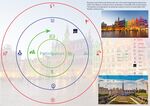
'''Author 5: | '''Author 5: Mahsa Bazrafshan''' | ||
*..... | *Concept 1: Place-Making | ||
*.. | Place-making is defined as an iterative process which required complexity to work in different context, with different communities and for different outcomes. This process emphasized flexibility, embraces impermanence, shares information, and draws on unorthodox sources of influence. The contemporary challenge of place makers is to address the pressing needs of our cities in a way that transcends physical place and empowers communities to address these challenges on an ongoing basis. Put into practice, placemaking seeks to build or improve public space, spark public discourse, create beauty and delight, connect neighbourhoods, support community health and safety, grow social justice, catalyzed economic development, promote environmental sustainability and of course nurture an authentic "sense of place". Regard9ing placemaking concept, authors introduce and analyse placemaking process in 13 different projects in a multi-geographical context. | ||
*Concept 2: A computer-based Modeling for city decision-makers | |||
This paper describes a model based on computer knowledge to develop a holistic model to meet all needs of urban planners. This tools covered two main categories; First, decision-oriented tools which include workshops and practical courses to involve citizens, Defined as visual, interactive, bottom-up process. Effective techniques will be brain-storming, design gaming, and visualization techniques. | |||
second; Analysis-oriented tools for performing the measurements and modelling the cities and future. so-called top-down process in computer modelling which include requiring related algorithms. Authors try to introduce a different type of modelling to reach a better understanding of future modelling. | |||
=== Step 5: Reflection === | === Step 5: Reflection === | ||
Rouhollah Rahimi:Visualization of climate change as part of the wider set of interacting global change | |||
influences and drivers of change at the landscape scale, modifed by national development policy | |||
and its implementation | |||
=== Step 6: Revised manifestoes === | === Step 6: Revised manifestoes === | ||
| Line 109: | Line 118: | ||
<gallery caption=" " widths="150px" heights="150px" perrow="5"> | <gallery caption=" " widths="150px" heights="150px" perrow="5"> | ||
Image: | Image:RevisedManifesto2 Susanna.jpg|Susanna's updated manifesto | ||
File:Landscape Democracy manifesto.jpg|Rouhollah Rahimi's updated manifesto | |||
Image: | Image:Petar Jurički revised manifesto.png|Petar Jurički's updated manifesto | ||
File:Landscape Democracy revised.jpg|Mahsa Bazrafshan, Modifeid Manifesto | |||
Image: | Image:Landscape manifesto-Eric.jpg|Eric Vitrier's updated manifesto | ||
</gallery> | </gallery> | ||
| Line 145: | Line 154: | ||
=== Landscape Symbols 4: ... === | === Landscape Symbols 4: ... === | ||
<gallery caption=" " widths="150px" heights="150px" perrow="5"> | <gallery caption=" " widths="150px" heights="150px" perrow="5"> | ||
File:Landscape Ellement Mahsa2.jpg|This picture reminds me a landscape element which represents the relationship between my colleague and me, we care about this plant to keep our office green. However, plants always count as a landscape element, ETHZurich. | |||
File:Landscape Ellement Mahsa1.jpg|Lakes and water bodies always consider as a landscape element, Lake Geneva, Switzerland. | |||
File:Landscape Ellement Mahsa3.jpg|This picture includes different elements of my surrounding landscape that I always pass through it to my workplace. Organic roads, sky, Trees and houses that designed by nature. Zurich Switzerland. | |||
</gallery> | </gallery> | ||
=== Landscape Symbols | === Landscape Symbols Rouhollah Rahimi: ... === | ||
<gallery caption=" " widths="150px" heights="150px" perrow="5"> | <gallery caption=" " widths="150px" heights="150px" perrow="5"> | ||
File:Landscape symbolism 1.jpeg|Landscape as a symbol of religion, one of the most renowned expositors of the psychology of religion, mythology, and magic--shows that myth and symbol constitute a mode of thought that not only came before that of discursive and logical reasoning, but is still an essential function of human consciousness. He describes and analyzes some of the most powerful and ubiquitous symbols that have ruled the mythological thinking of East and West in many times and at many levels of cultural development, Rome, Italy | |||
File:Landscape_as_a_collective_identity.jpg|Landscape as a collective identity, A theoretical framework is provided to understand a cultural group's definition of and relationship with nature and the environment. The framework draws on a social constructionist perspective that includes aspects of phenomenology and symbolic interactionism to define “landscape” as the symbolic environment created by a human act of conferring meaning on nature and the environment. This landscape reflects the selfdefinitions of the people within a particular cultural context,Rome, Italy | |||
File:Landscape_as_an_art.5.jpg|Landscape as an art, Therapeutic landscapes are places, settings, situations, locales, and milieus that encompass both the physical and psychological environments associated with treatment or healing, and the maintenance of health and well-being, Rome, Italy | |||
</gallery> | </gallery> | ||
| Line 160: | Line 169: | ||
== Assignment 3 - Role Play on Landscape Democracy "movers and shakers" == | == Assignment 3 - Role Play on Landscape Democracy "movers and shakers" == | ||
*You can read more details about this assignment [[Assignment_3:_Role_Play_on_Landscape_Democracy_"movers_and_shakers"_(2018)|here]] | *You can read more details about this assignment [[Assignment_3:_Role_Play_on_Landscape_Democracy_"movers_and_shakers"_(2018)|here]] | ||
Petar Jurički - Robert Jungk | |||
Rouhollah Rahimi - Karl Linn | |||
== Assignment 4 - Your Landscape Democracy Challenge == | == Assignment 4 - Your Landscape Democracy Challenge == | ||
*You can read more details about this assignment [[Assignment_4:_Your_Landscape_Democracy_Challenge_(2018)|here]] | *You can read more details about this assignment [[Assignment_4:_Your_Landscape_Democracy_Challenge_(2018)|here]] | ||
*Each group member will specify a landscape democracy challenge in his/her environment | *Each group member will specify a landscape democracy challenge in his/her environment | ||
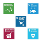
*Each Landscape Democracy Challenge should be linked to two or three of [https://www.un.org/sustainabledevelopment/sustainable-development-goals/ UN's 17 sustainable development Goals] | |||
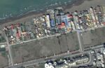
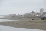
=== Landscape Democracy Challenge 1 === | === Landscape Democracy Challenge 1, Rouhollah Rahimi === | ||
<gallery caption=" | <gallery caption="Landscape of seaside in Babolsar,Iran" widths="150px" heights="150px" perrow="7"> | ||
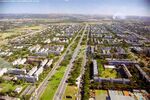
File:Landscape challenge.7.jpg|The beachfront of Babolsar is currently being created by dispersed and temporary caterpillars, which has created an unpleasant display. The direct connection of people to the sidewalk using the coastal edge through the adjacent streets leading to the coastal streets and indirect communication by walking on the alleys around the beach and along the edge of the sea. | |||
File:Landscape challenge.2.jpg|Failure to adhere to the seafront in some places | |||
File:Landscape challenge.1.jpg|Lack of attention to garbage collection and environmental pollution | |||
File:Landscape challenge.3.jpg|Governmental organs, municipal | |||
File:704B5521-E80A-4954-A683-27AEB837223C.jpeg|Sustainable Cities and Communities | |||
File:64F088D1-EC20-4B69-8D54-320DF3C55838.jpeg|Clean Water and Sanitation | |||
</gallery> | </gallery> | ||
'''Your references:''' | '''Your references:''' | ||
*... | *- Allison And Other. “Effect of coastal development up on water quality and habitat” . | ||
*- Kay & Alder.“Coastal planning and management”. | |||
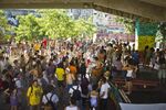
=== Landscape Democracy Challenge 2, Petar Jurički === | |||
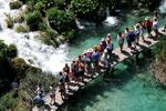
<gallery caption="Contamination of Plitvice Lakes" widths="150px" heights="150px" perrow="7"> | |||
Image:Petar Jurički, Challenge 1.jpeg|'''Plitvice Lakes''' is largest and the oldest national park in Croatia.The park is located in the Mala Kapela mountain range in the northwest and west, and the Lička Plješevica mountain range to the southeast. On 8. April 1949, it was proclaimed Croatia's first national park. Because of the tufa formation process on the lakes Plitvice Lakes were internationally recognised in 1979 with their inscription onto the UNESCO World Heritage List. In 2014 croatian parlament introduced new spacial development plan for villages around national park that triggered several alarming issues that put Plitvice lakes to danger of losing the status of the UNESCO World Heritage site. | |||
Image:Petar Jurički, Challenge 2.jpg|'''1. issue/conflict:''' Because of the spacial development plan that has been introduced people started building houses/apartments illegaly and legally in the vicinity, with that they started degrading the enviroment of the national park and they also connected their septic tanks without a purifier to the waterway of the river that contaminated the water and made it unsafe to drink or to wash your hands in it. With that said, contamination of water also started to affect tufa forming microorganisms that are the main driving force and core of the natural beauty of the national park. People were not happy with the situation and there were a lot protests. | |||
Image:Petar Jurički, Challenge 3.jpg|'''2. issue/conflict:''' Each year national park is visited by milions of tourists that make the national park very crowded. With that many tourist around it is really difficult to monitor the littering that takes places inside of the national park. Also, there is no limit to how many people should be in the park at the same time or any kind of a regulation that could prevent or reduce the littering. Considering all listed issues, UNESCO threatened to remove Plitvice Lakes from the list of World Heritage sites if certain measures were not taken. In 2018 spacial development plan was corrected and updated to address the issue of contamination and construction of apartments but there are still no regulations for quantity of tourists and measures to reduce their impact on the national park. | |||
Image:Petar Jurički, Challenge 4.jpg|'''In this particular case the main actors are:''' UNESCO, National park "Plitvice Lakes" as an institution, The Croatian parlament, Ministry of construction, Ministry of environment protection, apartment owners and public. | |||
Image:Petar Jurički, Challenge 6.png|'''We can relate this issue to 5 UN's Sustainable Development Goals''', that are not so positive in this case, that include good health and well-being (contaminated water is not safe for human population and health), clean water and sanitation (water contamination, unhygenic polluted water, no purifiers for septic waste), life below water (water contamination affected water wildlife and microorganisms), decent work and economic growth (illegal construction of apartments) and peace, justice and strong institutions (Ministry of construction has more power than Ministry of environment protection, struggle between people and government). | |||
</gallery> | </gallery> | ||
'''Your references:''' | '''Your references:''' | ||
*... | * https://np-plitvicka-jezera.hr/en/about-the-park/general-information/ | ||
*... | * https://www.24sata.hr/news/smrt-hrvatskog-bisera-plitvice-su-pune-fekalija-i-pesticida-552262 | ||
* https://dnevnik.hr/vijesti/hrvatska/plitvickim-jezerima-plivaju-fekalije-problem-treba-hitno-rijesiti-to-je-ekoloska-bomba---466512.html | |||
* https://www.saborsko.net/index.php/arhiva-clanaka/521-zbog-sve-vise-turista-na-plitvickim-jezerima-raste-nekontrolirana-apartmanizacija-a-u-jezero-se-ispustaju-fekalije | |||
* https://www.tportal.hr/vijesti/clanak/otkrivamo-detalje-o-zagadenju-vode-na-plitvicama-i-kako-se-to-pokusava-zataskati-foto-20171213 | |||
* https://www.vecernji.hr/vijesti/u-plitvickoj-vodi-fekalije-deterdzenti-pesticidi-1213464 | |||
* http://www.startnews.hr/news/vidio-i-slike-s-plitvickih-jezera-gdje-je-sve-manje-vode-a-sve-vise-govana-gdje-2-novonastala-sramotna-jezera-prijete-ekocidom/ | |||
* http://sd.live.sistemi.hr/sport/kosarka/clanak/id/250792/categoryid/40/plitvicka-jezera--neopisiva-ljepota-koju-treba-dozivjeti | |||
* http://www.fantasiatravel.hr/plitvicka-jezera-legenda-o-crnoj-kraljici.aspx | |||
* https://www.express.hr/top-news/dosje-plitvice-kako-smo-unistili-nase-cudo-prirode-13638 | |||
* https://www.un.org/sustainabledevelopment/sustainable-development-goals/ | |||
=== Landscape Democracy Challenge | === Landscape Democracy Challenge: Susanna Patata === | ||
<gallery caption=" | <gallery caption=""Dandara" illegal settlement in Belo Horizonte, Brazil" widths="150px" heights="150px" perrow="7"> | ||
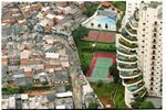
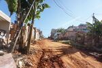
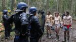
Image: | Image:Favelas.jpg|According to Brazilian latest demographic census, around 11.4 million people are living in illegality. The 80% of these informal settlements are concentrated in 20 largest cities and metropolitan areas, including Belo Horizonte. This is how over 6% of our urban population has historically found a way to live in the city in face of the insufficient and weak governmental program for the poorest. Dandara occupation was created in 2009 in a area unoccupied since 70s. It's considered the largest organized and planned occupation in Brazil, whit a population of 5000 residents, but they're still waiting for the urban and juridical regularization, that means basic infrastracture and housing. It's located in the region of Pampulha where there's also the UNESCO site of architect Oscar Niemeyer Modern Ensemble, that's make the matter of urban upgrading even more urgent. | ||
Image: | Image:DSC00752.jpg|LACK OF BASIC INFRASTRUCTURE/AFFORDABLE HOUSING/HEALTH AND ENVIRONMENTAL RISKS. Need of urban regularization that's possible only with the unoccupying of the permanent protection area. This contrast between the formal and the informal city is directly linked with the production of urban space since the foundation of the city. In Belo Horizonte the city center was planned to create a modern ideal city but the plan didn't consider the rapid transformation process of the city. The increasing demand of space and the inflation of land's price didn't allowed a democratic access to the urban space. In the middle of XX century slums started growing exponentially. Today the most urgent problem in terms of are the basic infrastructure, affordable housing. | ||
Image: | Image:Image preview.jpg| RACIAL SEGREGATION AND SOCIAL INEQUALITY. This differences in environment quality reflects the marked difference in the Brazilian society between poor and rich people, black and white. Even though so many improvements are still being done, remains the racial division: who is living in slums, the poorest, are mostly black people. This social division means a lack of opportunity for them. In Dandara settlement this difference is clearer as is located in the richest area of Belo Horizonte. | ||
Image: | Image:Stakeholder-company.jpg|ACTORS: People of the place, Design Professions, Public administration and institutions, citizens. | ||
Image:E_SDG-goals_Goal-11.png|UN's SUSTAINABLE GOAL: SUSTAINABLE CITIES AND COMMUNITIES. Provide the area with a sustainable and healthy environment could enabled people to advance socially and economically. | |||
Image:Transporto.jpg|UN's SUSTAINABLE GOAL: REDUCE INEQUALITIES: with a more dignity life, those people living in the slums could access to the formal city in terms of economic possibilities and cultural, social inclusion and reduce of poverty | |||
</gallery> | </gallery> | ||
'''Your references:''' | '''Your references:''' | ||
*... | *http://www.agenda2030.com.br | ||
*... | *https://nacoesunidas.org | ||
*https://www.ibge.gov.br | |||
*Borges Lemos C., Landre Marques Y., Luis de Melo Monte-Mor R., Soares de Moura Costa H., Belo Horizonte:espaços e tempos em construção, Belo Horizonte,PBH, 1994 | |||
*https://brigadaspopulares.org.br/aniversario-da-ocupacao-dandara-cinco-anos-de-luta/ | |||
=== Landscape Democracy Challenge 4 === | === Landscape Democracy Challenge 4, Eric V === | ||
<gallery caption=" | <gallery caption="The biggest landscape conflict in Western Europe : Notre-Dame-des-Landes" widths="150px" heights="150px" perrow="7"> | ||
Image: | Image:Eric Landscape Democracy Challenge Main Topic 2.jpeg|The Grand Ouest Airport project is a project of a brand new airport, located 30 kilometers northwest of the French city of Nantes in the Notre-Dame-des-Landes commune. It aims to replace the Nantes airport with the new airport as the airport of Nantes, and it is also an international gateway in western France. The 580 million euro project was approved in February 2008 and is expected to start in 2014 and open in 2017. Initially the airport was planned to have a capacity of 4 million passengers per year and it would increase to 9 million by 2050. Compared to the current capacity of the Nantes Atlantic that reaches 3 million passengers a year, its claimed capacity cannot be increased because of the distance between the airport and the city center. Opponents claim that the Nantes Atlantic can increase its capacity to 4 million people per year. The new airport plans to have two runways and is connected to the French highway and rail network. Despite the support of the French Socialist Party, the airport was strongly opposed, in particular by Greens. Various groups also established many protest camps and tents around the area. These camps and buildings will be called "ZAD" ("defense area"). On January 17, 2018, prime minister Edouard Philippe announced that the airport project was definitively cancelled. | ||
Image: | Image:Eric Landscape Democracy Conflict 1.jpeg|The airport project in Notre-Dame-des-Landes provides 962 hectares of wetlands and groves. This area has even increased to several thousand hectares with the planned service infrastructure in the medium and long term (tram-train, TGV ...). Yet these wetlands are precious. True sponges, they regulate floods and shunts, store carbon or abit as well as biodiversity, undeniable advantages of climate change. Destroying these ecosystems means destroying part of the solution to many problems. The most demanding of these natural environments and preliminary construction project, the law requires to study if it is possible to avoid the destruction of this nature. If this is not the case, it imposes to reduce these destructions then to compensate, that is to say to repair or restore on another ground the ecosystem which was destroyed. | ||
Image: | Image:Eric Landscape Democracy Conflict 2.jpeg|Hecatomb in sight for wildlife : The Notre-Dame-des-Landes site is home land for more than 2,000 animals and plant species and 5 natural areas of ecological fauna and flora. With 11 natural habitats at European stake, the site could also claim a classification in Natura 2000 zone. Over the 2,000 species listed, over a hundred are classified as protected species. And the inventory of the wonders of the place is far from being closed. The painstaking work of Naturalists in struggle, a collective in which the activists of associations are very active, allowed for example to discover species not listed in the inventory of the office of study of the Biotope mandated by the State. This is one of many examples of the many failures of this inventory, a tool that is crucial in a project since the avoidance, reduction and compensation measures result from it. | ||
Image: | Image:Eric Landscape Democracy Conflict 3.jpeg|TODAY : DEFENDING ZONE - NEW ANARCHY ZONE. Initially the establishment of a ZAD (Area to defend), that is to say the fact of occupying permanently and for an indefinite period a given space to protect its integrity, was considered by the opponents as the best mode operatory to prevent the start of work scheduled by the government. it became a societal project to defend, and has been shifted from the status of a means used in the service of an environmental struggle to that of an alternative design. The ZAD became at the end itself the moment when the opponents decided to "inhabit the place politically", occupying actively the space "to defend". They decided to give the criticism of "the airport and its world" a positive and remarkable content through the construction of dozens "places of life", the exploitation of land, or the development of new forms of society. They have co-produced a lot and co-built. They sought to "do together" in the places they occupied in order to develop "commons" and thereby contribute to "the building of a commune and a common future". The ZAD has become an open, connected and circulating political space, saturated with social and ecological experiments and heterogeneous practices that try to combine with the help of guiding ideas: self-government, egalitarian sharing of tasks, hospitality, gratuitousness, work without hierarchical subordination. | ||
Image:Eric Landscape Democracy Conflict 4.jpeg|The main actors are the French Government, the local population and some anti system anarchists. | |||
Image:Eric Landscape Democracy Conflict 5.jpeg|The population desperately protect the land use as if it was a nature protected area (in German “Naturschutzgebiet„). They don't wanna hear about that airport project protecting the life on land facing the police sent by the government. Their aim : To do climate action against this high infrastructure project, facing the government, taking the area as their new home illegally living there 24/24 (h) 7/7 (d), doing anti system manifestation, anarchy. | |||
</gallery> | </gallery> | ||
'''Your references:''' | '''Your references:''' | ||
*... | * http://mobile.lemonde.fr/planete/article/2018/01/17/notre-dames-des-landes-cinquante-ans-de-batailles_5242953_3244.html | ||
*... | * http://www.lefigaro.fr/actualite-france/2018/04/23/01016-20180423ARTFIG00074-nddl-les-negociations-houleuses-des-zadistes-et-de-l-etat-en-six-actes.php | ||
* https://www.fne.asso.fr/dossiers/notre-dame-des-landes-12-raisons-de-dire-non | |||
* https://www.latribune.fr/opinions/tribunes/notre-dame-des-landes-pourquoi-les-zadistes-ne-sont-pas-partis-774896.html?amp=1 | |||
* https://en.m.wikipedia.org/wiki/Aéroport_du_Grand_Ouest | |||
=== Landscape Democracy Challenge , Masha's challenge === | |||
<gallery caption="Ineraction with natural heritage; Badab Sourt springs, Iran" widths="150px" heights="150px" perrow="7"> | |||
File:Landscape democracy chanlleneges-11.jpg| | |||
File:Landscape democracy chanlleneges-12.jpg| | |||
</gallery> | </gallery> | ||
amp=1 | |||
== Assignment 5 - Your Democratic Change Process == | == Assignment 5 - Your Democratic Change Process == | ||
| Line 227: | Line 265: | ||
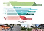
<gallery caption="Add Title" widths="600px" heights="300px" perrow="1"> | <gallery caption="Add Title" widths="600px" heights="300px" perrow="1"> | ||
Image: | Image:Context1 Assignment 5.jpg|Scenario's context 1/2 | ||
Image: | Image:Context2 Assignment 5.jpg|Scenario's context 2/2 | ||
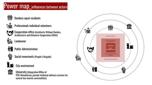
Image: | Image:Stakeholders Assignment 5 .jpg|Actors and stakeholders: who are, how are they interrelated and what is the power structure among them. Who is more affected by the change process? (in the circles) Who are the powerful actors? (in the rectangles) | ||
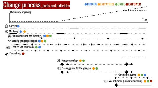
Image: | Image:Changeprocess Assignment 5.jpg|Our change program: activities and tools. How they are connected each other in a short, medium, long term. | ||
</gallery> | </gallery> | ||
=== Reflection === | === Reflection === | ||
Working on this challenge, and how to change it, made us realise that there are different actors with different power levels involved in the process. In this case are squat residents, individual volunteers, social movements, universities, cooperation office, citizens, landowner and a public administration. | |||
For understanding this challenge we needed to understand how were they interconnected with each other and to what extent they cooperate or conflict each other. We realised that many factors affect the way that people and professionals perceive the landscape and that the perception of landscape is different from country to country and its culture. So, whatever our professional, cultural, social background is re-thinking our role of movers of the change: educating and activate changing (physical, social...) without impose a classic change scenario. | |||
We concluded that the people should be involved in the planning and design process because the design and plan we are doing, we are doing for the people that live or will live there. | |||
In this case it is really important to include people of different economic and social backgrounds and not just the ones that have balanced or high economical or social status. People need to be included in all development processes through workshops, meetings and interaction between them, professionals and government so that the final outcome has the highest possible quality for the people, landscape and urban development of cities. To make this a reality it is also important to consider that in some cases (like this scenario and other poor communities cases) people don’t attend a proper education so it’s important to make them able to understand each technical aspects through tools that could involve, educate and entertain them. | |||
=== Your references === | === Your references === | ||
* ... | |||
* .. | *LED lectures | ||
* . | *New Urban Agenda, Quito Declaration on Sustainable Cities, | ||
*Lynch K.,, The image of the city, | |||
*Arnstein S., A ladder of citizen participation, | |||
*Day C., Consensus Design, | |||
*Hester R., A refrain with a view, | |||
*Case studies (Los Angeles Rives…), Urban planning example using, | |||
*Games, Apps , Toolkits (Block by Block project in Kenya slum, Participatory Chinatown…, | |||
*Woodcraft, Saffron, et al,, Design for Social Sustainability: a framework for creating thriving new communities, | |||
*Hester R., Drawing-Technique for Participatory Design, | |||
*Welk Von Mossner, Alexa (2014): Cinematic Landscapes, In: Topos, No. 88, 2014. | |||
---- | ---- | ||
[[Category:Landscape Democracy Working Group 2018]] | [[Category:Landscape Democracy Working Group 2018]] | ||
Latest revision as of 14:16, 24 June 2018
--> Back to working group overview
Dear working group members. This is your group page and you will be completing the template gradually as we move through the seminar. Good luck and enjoy your collaboration!
Assignment 1 - Reading and Synthesizing Core Terminology
- You can read more details about this assignment here
- Readings are accessible via the resources page
Step 1: Your Landscape Democracy Manifestoes
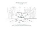
Susanna's manifesto
Rouhollah's manifesto
Petar's manifesto
Mahsa's Manifesto
Eric's manifesto

.jpg)


Step 2: Define your readings
- Please add your readings selection for the terminology exercise before April 18:
A: Landscape and Democracy
The New Urban Agenda Quito Declaration on Sustainable Cities and Human Settlements for All, UN resolution from December 2016 - Susanna Patata
Directive 2003/35/EC of the European Parliament and of the Council of 26 May 2003 providing for public participation in respect of the drawing up of certain plans and programmes relating to the environment and amending with regard to public participation and access to justice Council Directives 85/337/EEC and 96/61/EC - Statement by the Commission - Eric Vitrier
B: Concepts of Participation
Day, Christopher (2002): Consensus Design, Architectural Press - Petar Jurički
Hester, Randolph (1999): A Refrain with a View, UC Berkeley - Susanna Patata
C: Community and Identity
Welk Von Mossner, Alexa (2014): Cinematic Landscapes, In: Topos, No. 88, 2014. - Petar Jurički
Girling, Cynthia (2006): Informing Design Charrettes, The Integrated Assessment Journal - Mahsa Bazrafshan - 미안해 already taken -
Girling, Cynthia (2006): Informing Design Charrettes, The Integrated Assessment Journal - Eric Vitrier
D: Designing
Hester, Randolph: Democratic Drawing - Techniques for Participatory Design - Petar Jurički
Hester, Randolph: Democratic Drawing - Techniques for Participatory Design- R.Rahimi
Massachusetts Institute of Technology (2013): Places in the Making: How Placemaking Builds Places and Communities - Mahsa Bazrafshan
Massachusetts Institute of Technology (2013): Places in the Making: How Placemaking Builds Places and Communities - R.Rahimi
Woodcraft, Saffron, et al.: Design for Social Sustainability: A Framework for Creating Thriving New Communities - Susanna Patata
Woodcraft, Saffron, et al.: Design for Social Sustainability: A Framework for Creating Thriving New Communities- R.Rahimi
E: Communicating a Vision
Goldstein, B. E., A. T. Wessells, R. Lejano, and W. Butler. 2015. Narrating Resilience: Transforming Urban Systems Through Collaborative Storytelling. Urban Studies. 52 (7): 1285-1303. Eric Vitrier 'Reading the Landscape' by Simon Bell, EMU Tartu - R.Rahimi
Steps 3 and 4: Concepts Selection and definition
- Each group member selects three relevant concepts derived from his/her readings and synthesize them/publish them on the wiki by May 9, 2018
- Group members reflect within their groups and define their chosen concepts into a shared definition to be posted on the wiki by June 6, 2018.
- Other group members will be able to comment on the definitions until June 12, 2018
- Each group will also report on their process to come to a set of shared definitions of key landscape democracy concepts on the wiki documentation until June 20, 2018
Concepts and definitions
Author 1: Susanna Patata
- Concept 1: The New Urban Agenda was adopted at the United Nations Conference on Housing and Sustainable Urban Development (Habitat III) in Quito on 2016. Represents a shared vision for a better and more sustainable future where everybody have equal rights and access to the benefits and opportunities that the city can offer. The urban community reconsiders the urban system and physical form of our urban spaces to achieve this objective and recognize the correlation between good urbanization and development. It follows the principle of inclusivity; the meaningful inclusion of slum dwellers; the involvement of a wide range of stakeholders group, which have a critical role to play in the implementation of this shared vision. (The New Urban Agenda Quito Declaration on Sustainable Cities and Human Settlements for All, UN resolution from December 2016)
- Concept 2:Hester’s paper explore the development of participation. Since from the foundation of U.S. the local participation was considered an important right. With the professionalizing city management starts the separation of the citizens from the decisions about their landscape and the professionals assumed more and more responsibility in community design. With the creation of civil movements, the advocacy planning served the civil rights movement but it has had profound unintentional side effects that run counter to its original goals: visionary public plans. Participatory design has been transformed over the past three decades. Some trends evolved, some revised and all became more complex and varied depending upon local context. Today more people participate in local planning than before. The step for participatory design have to promote fairness and encourage creativity and innovation. (Hester, Randolph (1999): A Refrain with a View, UC Berkeley)
- Concept 3:The paper try to understanding how to plan and develop successful and socially sustainable communities. Building community is considered as important as designing in physical, economic and sustainable terms. The ‘social design’ approach must be considered in the practice of professionals involved in the design process of new and existed communities. The challenge to find a better planning practice is requested by the increasing pressure of urban population, climate change and ageing societies. The key of this good practice should begin from the awareness of how local identity and social networks influence people’s feelings of belonging to places in order to create more resilient and high quality communities. It discussed the fail experience of architecture that created isolated residents and dead, inflexible and costly spaces to maintain. (Woodcraft, Saffron, et al.: Design for Social Sustainability: A Framework for Creating Thriving New Communities)
Author 2: Petar Jurički
- Concept 1: Author thinks that the democracy is sometimes not the best solution for working out certain problems and for decision making in design. She suggests using the consensus approach as a mean for decision making among people involved in the design process. (Day, Christopher (2002): Consensus Design, Architectural Press)
- Concept 2: In the movie, the director uses landscape as a mean to make people more aware of the environmental crisis. In addition, we can conclude that landscape may contain meanings and stories about the communities around it as well as an emotional connection with the landscape they live in. (Welk Von Mossner, Alexa (2014): Cinematic Landscapes, In: Topos, No. 88, 2014.)
- Concept 3: Designers use creative methods (painting, sketching, collage etc.) as a mean to convey their ideas and thoughts to visualize places that are being designed. By drawing meaningful lines designers try to make the space they design precious to the people. Because of that, we need the participation of citizens and people from that area. Only through this kind of collaboration the lines and the design will have their true meaning to the people. (Hester, Randolph: Democratic Drawing - Techniques for Participatory Design)
Author 3: Eric Vitrier
- Concept 1: How to manage and apply: Environmental Planning, Access-to-information, Legal proceedings / administrative proceedings, Access-to-justice, Governance, Public participation defined by articles
- Concept 2: The author has developed computer-aided decision support tools to provide training, visualization, and modelling of character design (design-driven, participating community design activities) and other major public seminars. Design information. This tool was created to connect the public with community planning and design professionals. One of the goals of this task is to eliminate important knowledge gaps between experts and stakeholders who are responsible for preparing and evaluating program options. Design features show expectations and preferences for future development through a participatory, qualitative, and design-based approach that appeals to the general public, such as vision and brainstorming techniques. To achieve a more sustainable urban structure, you must support charrete through quantitative methods of modelling and measuring performance based on sustainable development indicators such as housing density and traffic access and services.
- Concept 3: According to a proposal for a new urbanization in Orange County, California, proposals that try to ignore various kinds of knowledge will damage the experience and common sense of urban residents. In this article, the author talks about how to reintegrate the river in Los Angeles into urban life and the efforts of the US fire department to cope with the crisis of forest fires. In either case, the participants are not even required to expand the story of alternative gifts, promote critical learning, promote coordination and promote the organization of stakeholders. Offering a story is a means to express the subjective symbolic importance of elasticity. We can enlighten and include some voices and we can decide how we can adapt through a self-organizing process and be able to determine profit. How can the community improve the social environmental adaptability of complex urban systems?
Author 4: Rouhollah Rahimi
- Concept 1: What makes a visually appealing landscape? How can the design and use of a landscape be harmonised? These are just some of the questions tackled in this refreshing approach to the subject. In Elements of Visual Design in the Landscape, the author explains a range of design principles. This new edition includes revised and updated text that will link to other areas of research and disciplines such as aesthetic philosophy and psychology. A third of the photographs have been replaced with new photographs showing better and more recent examples and also reflecting landscape in a wider range of countries.
- Concept 2: The professions working in the countryside-foresters, land agents, engineers are practical people well versed in the functional side of their work but perhaps not so comfortable when it comes to dealing with visual issues. He believes that it is increasingly important to be able to discuss and use visual design principles in a rational and structured way. The catalogue of principles is not entirely new, being familiar to architects, landscape architects and urban designers, but there is a need to extend their application from built or predominantly urban environments into the wider landscape where three dimensions are more important, where the scale is bigger and where natural patterns and processes predominate over man-made ones.
- Concept 3 :READING THE LANDSCAPE
• Understanding the landscape, the processes that formed it and the pressures for change is an important step before landscape planning or design, especially at a large scale. • It includes more than a geographical understanding – the visual and experiential aspects must be included. • The landscape is “… an area, as perceived by people, whose character is the result of the action and interaction of natural and/or human factors”. • Visual and experiential aspects can be considered from the point of view of the perceiver – in the landscape, as it is seen from various viewpoints. • Other sensory aspects can be noted while out there making analytical sketches.
Author 5: Mahsa Bazrafshan
- Concept 1: Place-Making
Place-making is defined as an iterative process which required complexity to work in different context, with different communities and for different outcomes. This process emphasized flexibility, embraces impermanence, shares information, and draws on unorthodox sources of influence. The contemporary challenge of place makers is to address the pressing needs of our cities in a way that transcends physical place and empowers communities to address these challenges on an ongoing basis. Put into practice, placemaking seeks to build or improve public space, spark public discourse, create beauty and delight, connect neighbourhoods, support community health and safety, grow social justice, catalyzed economic development, promote environmental sustainability and of course nurture an authentic "sense of place". Regard9ing placemaking concept, authors introduce and analyse placemaking process in 13 different projects in a multi-geographical context.
- Concept 2: A computer-based Modeling for city decision-makers
This paper describes a model based on computer knowledge to develop a holistic model to meet all needs of urban planners. This tools covered two main categories; First, decision-oriented tools which include workshops and practical courses to involve citizens, Defined as visual, interactive, bottom-up process. Effective techniques will be brain-storming, design gaming, and visualization techniques. second; Analysis-oriented tools for performing the measurements and modelling the cities and future. so-called top-down process in computer modelling which include requiring related algorithms. Authors try to introduce a different type of modelling to reach a better understanding of future modelling.
Step 5: Reflection
Rouhollah Rahimi:Visualization of climate change as part of the wider set of interacting global change influences and drivers of change at the landscape scale, modifed by national development policy and its implementation
Step 6: Revised manifestoes
- please look again at your initial manifestoes and update them with any new aspects/prespectives you have taken up during this seminar
Susanna's updated manifesto
Rouhollah Rahimi's updated manifesto
Petar Jurički's updated manifesto
Mahsa Bazrafshan, Modifeid Manifesto
Eric Vitrier's updated manifesto


Assignment 2 - Your Landscape Symbols
- You can read more details about this assignment here
Landscape Symbols Petar Jurički: ...
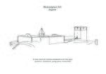
It was used for various purposes during the ages. (fortress, residence, party place, memorial), Zagreb
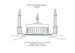
Its purpose changed because of the political situation in the country. (art gallery, mosque, art gallery), Zagreb
Forest/park was influenced by political actions during second world war. (forest, execution area and a graveyard, memorial park), Zagreb


Landscape Symbols Susanna Patata: ...
Santa Tereza's viaduct was designed to be a symbol of modern urban ideas and it’s one of the most important work of urban engineering in Minas Gerais.The Viaduct was an important urban reference for the generations of writers and artists over the time. In the Sixties, with the huge and uncontrolled urbanization of the city and the progressive impoverishment of the city center, became the image of urban space segregation, unexploited by the citizens because dangerous.It's just recently that this área, as a consequence of a regeneration urban process supported by the citizens themself, especially few social movement and youngers, became again an important urban landmark linked with culture and music production in the city.Every week underneath the Viaduct a urban music competition takes place, joining people from different social background.
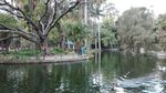
Municipal park in Belo Horizonte is a symbol of urban democracy.It was planned and conceived before the foundation of the city itself to keep part of the original brazilian forest into the city of Belo Horizonte as a park. After the urbanization, it was reduced to a quarter part of its original project but still nowaday it's one of the few green and public spaces into a city of 2 million of inhabitants. Here everybody can rest far from cars, noise, and the urban heat, homeless people as well. In addition to be a haven for the ecosystem and natural resources is also an architectural and cultural interest área with an ancient Theatre, playground and the cultural center ‘Palacio das Artes’ of the brazilian architect Oscar Niemeyer.
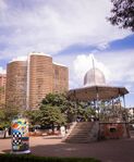
Liberty Square (Praça da Liberdade) today it's a recognized democratic symbol from the people of the city.Belo Horizonte was inaugurated 8 years after the founding of the Republic and the square, symbol of the Republic Power, was conceived in the the highest place of the city center, overlooking the landscape unlike the historical colonial towns where are the churches that prevailed in the landscape. (like Ouro Preto, colonial Portuguese towns and first capital of Minas Gerais state). Moreover the square has not only an historical meaning but it's also a charming place, syntheses of different architectural styles, where the gardens, avenues and monuments’ facada were inspired by french architecture. With few cultural spaces and free activities such as exposition, theater, library and others, the square has a cultural, social, political meaning recognized by all the citizens.


Landscape Symbols Author 3: ...
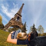
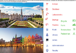
I was born in Paris and my girlfriend sent me this picture a few minutes ago and she said : „My love, I would like to take a picture with you like this“. She owns this monument in her room since her childhood and it's her deep dream. At that moment, I immediately saw that we commonly agree this „thing“ as a symbology. It's a matter of eternal love ❤️
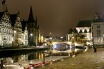
Gent in Belgium with St Michael's Bridge is considered as a Symbol in Belgium.
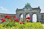
💐🏢 Triumphal Arch Cinquantenaire Park is considered as a landscape symbol in Brussels. 🇧🇪 🌷


Landscape Symbols 4: ...
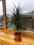
This picture reminds me a landscape element which represents the relationship between my colleague and me, we care about this plant to keep our office green. However, plants always count as a landscape element, ETHZurich.
Lakes and water bodies always consider as a landscape element, Lake Geneva, Switzerland.
This picture includes different elements of my surrounding landscape that I always pass through it to my workplace. Organic roads, sky, Trees and houses that designed by nature. Zurich Switzerland.


Landscape Symbols Rouhollah Rahimi: ...
Landscape as a symbol of religion, one of the most renowned expositors of the psychology of religion, mythology, and magic--shows that myth and symbol constitute a mode of thought that not only came before that of discursive and logical reasoning, but is still an essential function of human consciousness. He describes and analyzes some of the most powerful and ubiquitous symbols that have ruled the mythological thinking of East and West in many times and at many levels of cultural development, Rome, Italy
Landscape as a collective identity, A theoretical framework is provided to understand a cultural group's definition of and relationship with nature and the environment. The framework draws on a social constructionist perspective that includes aspects of phenomenology and symbolic interactionism to define “landscape” as the symbolic environment created by a human act of conferring meaning on nature and the environment. This landscape reflects the selfdefinitions of the people within a particular cultural context,Rome, Italy
Landscape as an art, Therapeutic landscapes are places, settings, situations, locales, and milieus that encompass both the physical and psychological environments associated with treatment or healing, and the maintenance of health and well-being, Rome, Italy


Assignment 3 - Role Play on Landscape Democracy "movers and shakers"
- You can read more details about this assignment here
Petar Jurički - Robert Jungk
Rouhollah Rahimi - Karl Linn
Assignment 4 - Your Landscape Democracy Challenge
- You can read more details about this assignment here
- Each group member will specify a landscape democracy challenge in his/her environment
- Each Landscape Democracy Challenge should be linked to two or three of UN's 17 sustainable development Goals
Landscape Democracy Challenge 1, Rouhollah Rahimi
- Landscape of seaside in Babolsar,Iran
The beachfront of Babolsar is currently being created by dispersed and temporary caterpillars, which has created an unpleasant display. The direct connection of people to the sidewalk using the coastal edge through the adjacent streets leading to the coastal streets and indirect communication by walking on the alleys around the beach and along the edge of the sea.
Failure to adhere to the seafront in some places
Lack of attention to garbage collection and environmental pollution
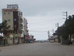
Governmental organs, municipal
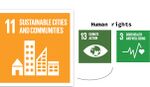
Sustainable Cities and Communities
Clean Water and Sanitation


Your references:
- - Allison And Other. “Effect of coastal development up on water quality and habitat” .
- - Kay & Alder.“Coastal planning and management”.
Landscape Democracy Challenge 2, Petar Jurički
- Contamination of Plitvice Lakes
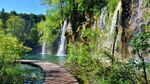
Plitvice Lakes is largest and the oldest national park in Croatia.The park is located in the Mala Kapela mountain range in the northwest and west, and the Lička Plješevica mountain range to the southeast. On 8. April 1949, it was proclaimed Croatia's first national park. Because of the tufa formation process on the lakes Plitvice Lakes were internationally recognised in 1979 with their inscription onto the UNESCO World Heritage List. In 2014 croatian parlament introduced new spacial development plan for villages around national park that triggered several alarming issues that put Plitvice lakes to danger of losing the status of the UNESCO World Heritage site.
1. issue/conflict: Because of the spacial development plan that has been introduced people started building houses/apartments illegaly and legally in the vicinity, with that they started degrading the enviroment of the national park and they also connected their septic tanks without a purifier to the waterway of the river that contaminated the water and made it unsafe to drink or to wash your hands in it. With that said, contamination of water also started to affect tufa forming microorganisms that are the main driving force and core of the natural beauty of the national park. People were not happy with the situation and there were a lot protests.
2. issue/conflict: Each year national park is visited by milions of tourists that make the national park very crowded. With that many tourist around it is really difficult to monitor the littering that takes places inside of the national park. Also, there is no limit to how many people should be in the park at the same time or any kind of a regulation that could prevent or reduce the littering. Considering all listed issues, UNESCO threatened to remove Plitvice Lakes from the list of World Heritage sites if certain measures were not taken. In 2018 spacial development plan was corrected and updated to address the issue of contamination and construction of apartments but there are still no regulations for quantity of tourists and measures to reduce their impact on the national park.
In this particular case the main actors are: UNESCO, National park "Plitvice Lakes" as an institution, The Croatian parlament, Ministry of construction, Ministry of environment protection, apartment owners and public.
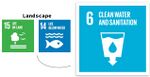
We can relate this issue to 5 UN's Sustainable Development Goals, that are not so positive in this case, that include good health and well-being (contaminated water is not safe for human population and health), clean water and sanitation (water contamination, unhygenic polluted water, no purifiers for septic waste), life below water (water contamination affected water wildlife and microorganisms), decent work and economic growth (illegal construction of apartments) and peace, justice and strong institutions (Ministry of construction has more power than Ministry of environment protection, struggle between people and government).


Your references:
- https://np-plitvicka-jezera.hr/en/about-the-park/general-information/
- https://www.24sata.hr/news/smrt-hrvatskog-bisera-plitvice-su-pune-fekalija-i-pesticida-552262
- https://dnevnik.hr/vijesti/hrvatska/plitvickim-jezerima-plivaju-fekalije-problem-treba-hitno-rijesiti-to-je-ekoloska-bomba---466512.html
- https://www.saborsko.net/index.php/arhiva-clanaka/521-zbog-sve-vise-turista-na-plitvickim-jezerima-raste-nekontrolirana-apartmanizacija-a-u-jezero-se-ispustaju-fekalije
- https://www.tportal.hr/vijesti/clanak/otkrivamo-detalje-o-zagadenju-vode-na-plitvicama-i-kako-se-to-pokusava-zataskati-foto-20171213
- https://www.vecernji.hr/vijesti/u-plitvickoj-vodi-fekalije-deterdzenti-pesticidi-1213464
- http://www.startnews.hr/news/vidio-i-slike-s-plitvickih-jezera-gdje-je-sve-manje-vode-a-sve-vise-govana-gdje-2-novonastala-sramotna-jezera-prijete-ekocidom/
- http://sd.live.sistemi.hr/sport/kosarka/clanak/id/250792/categoryid/40/plitvicka-jezera--neopisiva-ljepota-koju-treba-dozivjeti
- http://www.fantasiatravel.hr/plitvicka-jezera-legenda-o-crnoj-kraljici.aspx
- https://www.express.hr/top-news/dosje-plitvice-kako-smo-unistili-nase-cudo-prirode-13638
- https://www.un.org/sustainabledevelopment/sustainable-development-goals/
Landscape Democracy Challenge: Susanna Patata
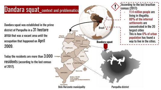
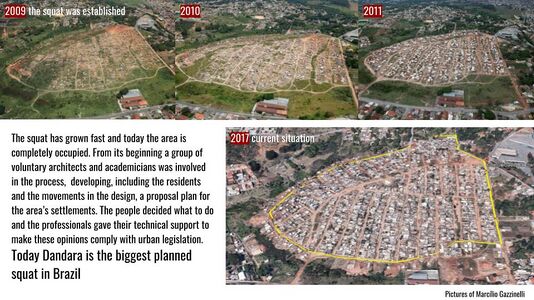
According to Brazilian latest demographic census, around 11.4 million people are living in illegality. The 80% of these informal settlements are concentrated in 20 largest cities and metropolitan areas, including Belo Horizonte. This is how over 6% of our urban population has historically found a way to live in the city in face of the insufficient and weak governmental program for the poorest. Dandara occupation was created in 2009 in a area unoccupied since 70s. It's considered the largest organized and planned occupation in Brazil, whit a population of 5000 residents, but they're still waiting for the urban and juridical regularization, that means basic infrastracture and housing. It's located in the region of Pampulha where there's also the UNESCO site of architect Oscar Niemeyer Modern Ensemble, that's make the matter of urban upgrading even more urgent.
LACK OF BASIC INFRASTRUCTURE/AFFORDABLE HOUSING/HEALTH AND ENVIRONMENTAL RISKS. Need of urban regularization that's possible only with the unoccupying of the permanent protection area. This contrast between the formal and the informal city is directly linked with the production of urban space since the foundation of the city. In Belo Horizonte the city center was planned to create a modern ideal city but the plan didn't consider the rapid transformation process of the city. The increasing demand of space and the inflation of land's price didn't allowed a democratic access to the urban space. In the middle of XX century slums started growing exponentially. Today the most urgent problem in terms of are the basic infrastructure, affordable housing.

RACIAL SEGREGATION AND SOCIAL INEQUALITY. This differences in environment quality reflects the marked difference in the Brazilian society between poor and rich people, black and white. Even though so many improvements are still being done, remains the racial division: who is living in slums, the poorest, are mostly black people. This social division means a lack of opportunity for them. In Dandara settlement this difference is clearer as is located in the richest area of Belo Horizonte.

ACTORS: People of the place, Design Professions, Public administration and institutions, citizens.
UN's SUSTAINABLE GOAL: SUSTAINABLE CITIES AND COMMUNITIES. Provide the area with a sustainable and healthy environment could enabled people to advance socially and economically.
UN's SUSTAINABLE GOAL: REDUCE INEQUALITIES: with a more dignity life, those people living in the slums could access to the formal city in terms of economic possibilities and cultural, social inclusion and reduce of poverty


Your references:
- http://www.agenda2030.com.br
- https://nacoesunidas.org
- https://www.ibge.gov.br
- Borges Lemos C., Landre Marques Y., Luis de Melo Monte-Mor R., Soares de Moura Costa H., Belo Horizonte:espaços e tempos em construção, Belo Horizonte,PBH, 1994
- https://brigadaspopulares.org.br/aniversario-da-ocupacao-dandara-cinco-anos-de-luta/
Landscape Democracy Challenge 4, Eric V
- The biggest landscape conflict in Western Europe : Notre-Dame-des-Landes
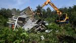
The Grand Ouest Airport project is a project of a brand new airport, located 30 kilometers northwest of the French city of Nantes in the Notre-Dame-des-Landes commune. It aims to replace the Nantes airport with the new airport as the airport of Nantes, and it is also an international gateway in western France. The 580 million euro project was approved in February 2008 and is expected to start in 2014 and open in 2017. Initially the airport was planned to have a capacity of 4 million passengers per year and it would increase to 9 million by 2050. Compared to the current capacity of the Nantes Atlantic that reaches 3 million passengers a year, its claimed capacity cannot be increased because of the distance between the airport and the city center. Opponents claim that the Nantes Atlantic can increase its capacity to 4 million people per year. The new airport plans to have two runways and is connected to the French highway and rail network. Despite the support of the French Socialist Party, the airport was strongly opposed, in particular by Greens. Various groups also established many protest camps and tents around the area. These camps and buildings will be called "ZAD" ("defense area"). On January 17, 2018, prime minister Edouard Philippe announced that the airport project was definitively cancelled.
The airport project in Notre-Dame-des-Landes provides 962 hectares of wetlands and groves. This area has even increased to several thousand hectares with the planned service infrastructure in the medium and long term (tram-train, TGV ...). Yet these wetlands are precious. True sponges, they regulate floods and shunts, store carbon or abit as well as biodiversity, undeniable advantages of climate change. Destroying these ecosystems means destroying part of the solution to many problems. The most demanding of these natural environments and preliminary construction project, the law requires to study if it is possible to avoid the destruction of this nature. If this is not the case, it imposes to reduce these destructions then to compensate, that is to say to repair or restore on another ground the ecosystem which was destroyed.
Hecatomb in sight for wildlife : The Notre-Dame-des-Landes site is home land for more than 2,000 animals and plant species and 5 natural areas of ecological fauna and flora. With 11 natural habitats at European stake, the site could also claim a classification in Natura 2000 zone. Over the 2,000 species listed, over a hundred are classified as protected species. And the inventory of the wonders of the place is far from being closed. The painstaking work of Naturalists in struggle, a collective in which the activists of associations are very active, allowed for example to discover species not listed in the inventory of the office of study of the Biotope mandated by the State. This is one of many examples of the many failures of this inventory, a tool that is crucial in a project since the avoidance, reduction and compensation measures result from it.
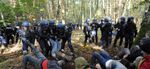
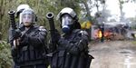
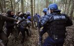
TODAY : DEFENDING ZONE - NEW ANARCHY ZONE. Initially the establishment of a ZAD (Area to defend), that is to say the fact of occupying permanently and for an indefinite period a given space to protect its integrity, was considered by the opponents as the best mode operatory to prevent the start of work scheduled by the government. it became a societal project to defend, and has been shifted from the status of a means used in the service of an environmental struggle to that of an alternative design. The ZAD became at the end itself the moment when the opponents decided to "inhabit the place politically", occupying actively the space "to defend". They decided to give the criticism of "the airport and its world" a positive and remarkable content through the construction of dozens "places of life", the exploitation of land, or the development of new forms of society. They have co-produced a lot and co-built. They sought to "do together" in the places they occupied in order to develop "commons" and thereby contribute to "the building of a commune and a common future". The ZAD has become an open, connected and circulating political space, saturated with social and ecological experiments and heterogeneous practices that try to combine with the help of guiding ideas: self-government, egalitarian sharing of tasks, hospitality, gratuitousness, work without hierarchical subordination.
The main actors are the French Government, the local population and some anti system anarchists.
The population desperately protect the land use as if it was a nature protected area (in German “Naturschutzgebiet„). They don't wanna hear about that airport project protecting the life on land facing the police sent by the government. Their aim : To do climate action against this high infrastructure project, facing the government, taking the area as their new home illegally living there 24/24 (h) 7/7 (d), doing anti system manifestation, anarchy.


Your references:
- http://mobile.lemonde.fr/planete/article/2018/01/17/notre-dames-des-landes-cinquante-ans-de-batailles_5242953_3244.html
- http://www.lefigaro.fr/actualite-france/2018/04/23/01016-20180423ARTFIG00074-nddl-les-negociations-houleuses-des-zadistes-et-de-l-etat-en-six-actes.php
- https://www.fne.asso.fr/dossiers/notre-dame-des-landes-12-raisons-de-dire-non
- https://www.latribune.fr/opinions/tribunes/notre-dame-des-landes-pourquoi-les-zadistes-ne-sont-pas-partis-774896.html?amp=1
- https://en.m.wikipedia.org/wiki/Aéroport_du_Grand_Ouest
Landscape Democracy Challenge , Masha's challenge
- Ineraction with natural heritage; Badab Sourt springs, Iran


amp=1
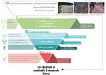
Assignment 5 - Your Democratic Change Process
- You can read more details about this assignment here
- After documenting and reflecting on your challenges you will continue jointly with one of these challenges and design a democratic change process
Your Democratic Change Process
- Add Title
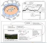
Scenario's context 1/2
Scenario's context 2/2
Actors and stakeholders: who are, how are they interrelated and what is the power structure among them. Who is more affected by the change process? (in the circles) Who are the powerful actors? (in the rectangles)
Our change program: activities and tools. How they are connected each other in a short, medium, long term.


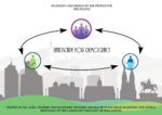
Reflection
Working on this challenge, and how to change it, made us realise that there are different actors with different power levels involved in the process. In this case are squat residents, individual volunteers, social movements, universities, cooperation office, citizens, landowner and a public administration.
For understanding this challenge we needed to understand how were they interconnected with each other and to what extent they cooperate or conflict each other. We realised that many factors affect the way that people and professionals perceive the landscape and that the perception of landscape is different from country to country and its culture. So, whatever our professional, cultural, social background is re-thinking our role of movers of the change: educating and activate changing (physical, social...) without impose a classic change scenario.
We concluded that the people should be involved in the planning and design process because the design and plan we are doing, we are doing for the people that live or will live there. In this case it is really important to include people of different economic and social backgrounds and not just the ones that have balanced or high economical or social status. People need to be included in all development processes through workshops, meetings and interaction between them, professionals and government so that the final outcome has the highest possible quality for the people, landscape and urban development of cities. To make this a reality it is also important to consider that in some cases (like this scenario and other poor communities cases) people don’t attend a proper education so it’s important to make them able to understand each technical aspects through tools that could involve, educate and entertain them.
Your references
- LED lectures
- New Urban Agenda, Quito Declaration on Sustainable Cities,
- Lynch K.,, The image of the city,
- Arnstein S., A ladder of citizen participation,
- Day C., Consensus Design,
- Hester R., A refrain with a view,
- Case studies (Los Angeles Rives…), Urban planning example using,
- Games, Apps , Toolkits (Block by Block project in Kenya slum, Participatory Chinatown…,
- Woodcraft, Saffron, et al,, Design for Social Sustainability: a framework for creating thriving new communities,
- Hester R., Drawing-Technique for Participatory Design,
- Welk Von Mossner, Alexa (2014): Cinematic Landscapes, In: Topos, No. 88, 2014.