LED Online Seminar 2017 - Working Group 1
--> Back to working group overview
Dear working group members. This is your group page and you will be completing the template gradually as we move through the seminar. Good luck and enjoy your collaboration!
Assignment 1 - Reading and Synthesizing Core Terminology
- You can read more details about this assignment here
- Readings are accessible via the resources page
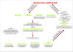
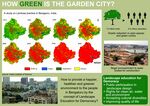
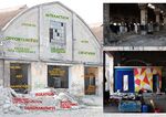
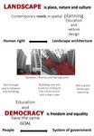
Step 1: Your Landscape Democracy Manifestoes
Step 2: Define your readings
- Please add your readings selection for the terminology exercise before April 12:
A: Landscape and Democracy - Mapping the Terrain
- The European Landscape Convention (Giya Elizabeth George)
Landscape Concepts:
- Lynch, Kevin. (1960): The Image of the City, Cambridge, Mass.: MIT Press (Giulia Chiussi)
- Bruns/Bartolomei, 2016 'Concepts of Landscape' (Saeid Saadat)
B: Concepts of Participation
- Hester, Randolph (2006): Design for Ecological Democracy - Fairness (Saeid Saadat)
- David, Harvey (2003): The Right to the City, International Journal of Urban and Regional Research, Volume 27, Issue 4, pages 939–941 (Giulia Chiussi)
C: Community and Identity
- Hester, Randolph (2006): Design for Ecological Democracy (Mansura Perveen)
- Welk Von Mossner, Alexa (2014): Cinematic Landscapes (Mansura Perveen)
- Nassauer, Joan Iverson (1995): Culture and Changing Landscape Structure, Landscape Ecology, vol. 10 no. 4. (Giulia Chiussi)
D: Designing
- Reading selected: Hester, Randolph: Life, Liberty and pursuit of Sustainable Happiness (Giya Elizabeth George)
- Vall, N. (2013): Social engineering and participation in Anglo-Swedish housing 1945–1976: Ralph Erskine's vernacular plan, Planning Perspectives, 28(2), 223-245 (Giulia Chiussi)
- Pritzker Prize winning architect Alejandro Aravena on sustainable design and community involvement in Chile (Mansura Perveen)
E: Communicating a Vision
- Participant: Haniyeh Golzardi
- Reading selected: Storytelling example from the Scottish Islands
- Online decision making with loomio
- Reading the Landscape' by Simon Bell, EMU Tartu
Steps 3 and 4: Concepts Selection and definition
- Each group member selects three relevant concepts derived from his/her readings and synthesize them/publish them on the wiki by April 30, 2017
- Group members reflect within their groups and define their chosen concepts into a shared definition to be posted on the wiki by May 10, 2017.
- Other group members will be able to comment on the definitions until May 20, 2017
Concepts and definitions
Giulia Chiussi:
- IMAGEABILITY (p.9 The image of the city (A), Kevin Lynch)
The property of an object to strike a chord of the observer. It can be given by the physical image but it also can be a feeling perceived through all the senses.
- AFFORDANCE (p.232 Culture and changing landscape structures (C), Joan Iverson Nassauer)
The emotional involvement between an object and his user: the shape of the object suggests the way to approach with. It's a potential property of a meeting.
- COMMUNITY TRUST (Ralph Erskine's vernacular plan, Natasha Vall)
Responsibility and belonging to the place where people live. It arise when there is tenant partecipation for planning and for financial issues.
Haniyeh Golzardi:
- The most important step before landscape planning is to understand the process that formed the landscape and the pressure for changes on that.('Reading the Landscape' by Simon Bell, EMU Tartu)
- Reading the landscape is not about the valuing it but it's about describing or characterising it and give the landscape a name.('Reading the Landscape' by Simon Bell, EMU Tartu)
- There is an eye-catching contrast between the centre of the town and the edges (surrounding) areas.As if the centre is more important than the other rest of the areas in the town.(Stromness, Urban Design Framework)
Giya Elizabeth George:('European Landscape Convention' and 'Life, Liberty and Pursuit of Sustainable Happiness').
- Enabling Form : We as individuals and communities are emotionally and intellectually unprepared to take the complex and comprehensive actions necessary for sustainability. We need new forms enabling us to sense, understand and empathize with the multiple roles in our ecosystem.
- Resilient Form : To be sustainable, cities must be more resilient. They must repair natural systems that have been stressed to the point of dysfunction and create new forms of habitation.
- Impelling Form : The nature of problems have changed, and public attitudes have changed. As a result, our urge to compel must be largely replaced by a need to impel.
Mansura Perveen:
- Cinematic Landscape (Reading Welk Von Mossner, Alexa (2014): Cinematic Landscapes)
Since our lives are dictated in so many ways by the environment we live in, the particularities of a landscape often seem to mirror certain feelings, and thus evoke our emotion & imagination. The attributes of such cinematic landscapes are not only geographical, but also socioeconomic in nature.
- Ecological Democracy (Reading Hester, Randolph (2006): Design for Ecological Democracy)
Ecological Democracy is a concept that advocates for an approach to designing our local environments, that involves direct participation (participatory democracy), that is guided by a comprehensive understanding of the organisms, habitats, and events of our surroundings (applied ecology); in order to ensure a more vigorous interactive landscape that can sustain an enduring & joyful urban life.
- 'Design's power of synthesis (Reading Pritzker Prize winning architect Alejandro Aravena on sustainable design and community involvement in Chile)
A good design has the capability to synthesize all the governing forces of a given constraint, however conflicting they may seem, and translate them into a form. The application of simple common-sense can often result into ingenious solutions to the most complex of problems.
Saeid Saadat:
- Fairness is fundamental to lasting democracy in an ecological democracy, citizens are responsible for obeying just laws and disobeying unjust ones. Above all conditions for a democratic society and design, equal access to information is critical for creating legitimate involvement and well-informed public.
- .......
- .......
Step 5: Reflection
The image of the city has to be strong and well organized because it allows people to move easily within. Then every city is necessarily dynamic because it’s composed by people who makes it alive by changing and living it. The intersection between the framework and the movement is our landscape and it has to reveal the cultural background, to satisfy people needs and to face with constant challenges between storytelling and give a chance to be a part of it.
Landscape is defined as interaction of human and non-human and the human perception of the resulting material phenomena like features and processes. In general perception of environment and landscape is different for each person in society and indeed it depends on experiences and context. So from the technical point of view, if the experts of this field (ecologist, landscape designer/planner and so on) are the community who can understand the value of landscape and distinguished variety of types with their own worth, they have major responsibility to spread their understanding in society. So by increasing the knowledge and awareness of people regarding their surroundings and their environmental identity people will try more to maintain and enhance it.
Understanding the landscape, the processes that formed it and the pressure for change is an important step before landscape planning or design. It is not about the valuing the landscape but it's about describing or characterising it and give the landscape a name. Character means a district, recognizable and consistent pattern of element in the landscape that makes one landscape different from another rather than better or worse.
Step 6: Revised manifestoes
- please look again at your initial manifestoes and update them with any new aspects/prespectives you have taken up during this seminar
- Updatedmanifesto1.jpg
xy's updated manifesto
- Updatedmanifesto2.jpg
xy's updated manifesto
- Updatedmanifesto3.jpg
xy's updated manifesto
- Updatedmanifesto4.jpg
xy's updated manifesto
- Updatedmanifesto5.jpg
xy's updated manifesto
Assignment 2 - Your Landscape Symbols
- You can read more details about this assignment here
Giulia Chiussi
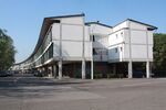
THE TRAIN this is a Giuseppe Vaccaro project. Vaccaro is the architect who built our Enineering and Architecture School Location and he conceived also this Democratic Space working with his team and people. Now it's still a place where people meet to take care of Everybody's Green. The Train is the name that people gave to this 'spine' Complex situated in the Barca District in Bologna. Via della Barca, Bologna. GEOlocation:44°29'42.9"N 11°17'06.0"E
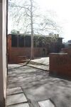
SPIRAL SQUARE this is a little square that is behind the San Domenico Basilica. Many of italian's squares are in front of churches, the symbol of the Christian Power, this is behind. It's intimate and gives you a plaesant close feeling with other people: the Big Tree in the eye connects all. The spiral ivites you to think: it gives you the possibility to perceive this sense of peace by giving your space. Vicolo dell'Orto, Bologna. GEOlocation:44°29'22.7"N 11°20'40.7"E
Haniyeh Golzardi
Giya Elizabeth George
Madras War Cemetery is a World War memorial cemetery in Chennai (Madras), Tamil Nadu, India, established in 1952 by the Imperial War Graves Commission, to pay tribute to the men and women who sacrificed their lives in World War II. The memorial does not contain any buried dead-bodies, but has plaques with the names of many British soldiers who died in both the World Wars, with the inscription ‘Their name liveth for evermore’. It symbolizes the sacrifice and noblest deeds of the soldiers along with the historical evidences of British rule in India. It is stylized as a lawn cemetery and is currently maintained by the Commonwealth War Graves Commission and Government of India. Geo location: 13° 0′ 51.48″ N, 80° 11′ 39.84″ E.
Shisha Gumbad (literal English translation: glass dome) is a tomb of the Lodhi Dynasty and is believed to have possibly been constructed in the late 15th century. There are four tombs in the Lodhi Gardens including the Shisha Gumbad. Initially, all the tombs were built independently and were not connected. In early 20th century, a park was developed which was inaugurated by Lady Willingdon bringing the four monuments into one garden. The garden is an important part of Indian history and is open for public access. Geo location: 28°35′37.3884″N 77°13′12.6192″E.
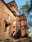
The Basilica of Bom Jesus (Portuguese: Basílica do Bom Jesus) is located in Goa, India. The basilica holds the mortal remains of St. Francis Xavier. The church is located in Old Goa, which was the capital of Goa in the early days of Portuguese rules. It is considered to be one of the best examples of baroque architecture in India and is a landmark in the history of Christianity. The Basilica of Bom Jesus is almost 412 years old and is open to the public every day. Geo location: 15°30′3.14″N 73°54′41.44″E.
Saeid Saadat
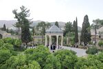
Hafezie Garden; is one of the outstanding gardens of Shiraz. In my eyes, this garden is sending considerable messages, which are note worthy. This place is holding different aspects of Iranian dignity;such as historical,political,traditional and cultural aspects. First of all, this garden was promoted during the Pahlavi dynasty and the amazing monument was constructed in that era as well. Secondly, the memorial structure is symbol of Hafez and his manner of living, which was designed by French Architect André Godard. Moreover, the Garden also is following the discipline of Persian Gardens,which dating back to more than 2500 years ago, with its logical axis and mathematical distribution of elements on context. Apart from all of these factor I should bring up these days condition of the place, this interesting place with its pavilion and open corridor is one of the rarest places in Shiraz which calls people, from every level of society without considering the gender, position or age to come and chill in great atmosphere. The Garden and the Tomb is welcoming people for reading Hafez poetry, singing different poems of different poets, celebrating new year or celebrating the religious events. So, liberality and democratic condition of this garden in this small scale can be felt if you have experienced life condition of non-democratic society like Iran. 29°37'32.9"N 52°33'29.8"E
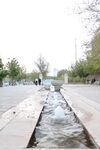
Chamran linear park, a place where people are spending time to have fun. This place was constructed along side a main boulevard(with same name). In this place different elements can be found which are representing combination of modern and classic arts. one of them is illustrated in this pic. A small stream which crossed a bowl and break it. the axis and the way of presenting are interesting. 29°39'10.5"N 52°30'03.5"E.
Mansura Perveen
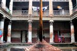
Ruplal House,a 19th century palace of great heritage value, decaying in negligence. Ruplal House,a 19th century palace of great heritage value in old Dhaka Bangladesh.This Neo classical architecture has been take possession by local settler. Ripped of the signs of its past grace and grandeur. This building should have been preserved heritage of old architecture in old city as manifest of its flourish history.This picture is taken in the “ Dhaka art summit” festival.Geo location 23° 42′ 13.1″ N, 90° 24′ 49.1″ E
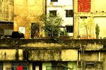
Dhaka is the densely populated city where density is 45,000 people per square kilometers. Closely knit, shabby looking low rise structures forming such unruly roof-scapes-a very common picture in Dhaka. The cow on the roof bears evidence of acute shortage of land in the densely populated city. This picture is taken before the 2nd largest religious festival. Geo location 23°47'07.0"N 90°25'06.2"E
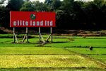
This photo is taken on the way of my village home :Modhukhali, Dhaka,Bnagladesh. Rich green paddy fields, spread across the horizon, is perhaps the most familiar picture of rural Bangladesh. And it is indeed remarkable how the limited arable lands of the country managed till now to supply such a large population with food. However, the greed of the real-estate developers, coupled with poor governance, is making it extremely difficult to save the agricultural lands from the grasp of the businessmen. Geo location 23°50'04.2"N 90°33'38.3"E
Assignment 3 - Role Play on Landscape Democracy "movers and shakers"
- You can read more details about this assignment here
- Christopher Alexander (The Oregon Experiment, Pattern Language) (Mansura Perveen)
Assignment 4 - Your Landscape Democracy Challenge
- You can read more details about this assignment here
- Each group member will specify a landscape democracy challenge in his/her environment
Landscape Democracy Challenge 1: Giulia Chiussi
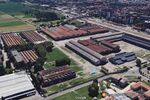
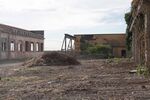
- Le Reggiane
Landscape Democracy Challenge 2 : Haniyeh Golzardi
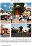
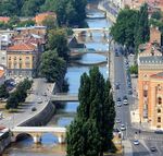
- Polluted River in Sarajevo
caption: The Miljacka is a rather small river, only 38 kilometres (24 mi) long with average discharge of 5.7 m³/s at the City of Sarajevo, and right tributary of the Bosna river. Hence the origin and the estuary, the Miljacka river flows from the east to the west.Due to Bosnian War water treatment was stopped and plant equipment looted preventing local government to deal with the issue as estimations to repair the wastewater plant run between 50 and 60 million euros.
caption: Because of its poor discharge, the Miljacka is known for its peculiar smell and brown waters.The main collector that drains the fecal matter is parallel with the flow of Miljacka up to its mouth to the river Bosna. The sewer system is not connected to the main collector, causing leakage of fecal matter directly into the waters of Miljacka on several places.
caption: General fact is that rivers are polluted because not even the very center of the city has entirely arranged discharge of waste waters into the collector. Moreover, another cause of pollution are sanitary waste waters (sewerage), disposal of trash in the vicinity of rivers, and the lack of sewerage network in the country and suburban settlements,“ stated the Institute.
References:
- https://en.wikipedia.org/wiki/Miljacka
- https://www.shutterstock.com/video/clip-9403907-stock-footage-pollution-floating-on-the-river-in-sarajevo-bosnia-and-herzegovina.html
- http://www.sarajevotimes.com/?p=99595
Landscape Democracy Challenge 3
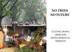
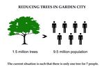
- FELLING DOWN TREES
Your references:
- https://asiancorrespondent.com/2015/10/cutting-emissions-intensity-can-india-lead-the-world-on-climate-change/#ue23mYXvDu8SVyk8.97
- http://www.greenpeace.org/india/en/Multimedia/Photos/Sankey-road-protest-No-trees-No-future/Protest-against-tree-cutting-on-Sankey-road/
- http://www.mastylecare.org/news/bengaluru-citizens-form-human-chain-against-bbmps-move-to-cut-down-112-trees-for-a-flyover/
Landscape Democracy Challenge 4: Mansura Perveen
- Give a title to your challenge
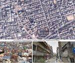
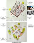
Dhaka is the most densely populated city on earth with almost 45,000 inhabitants living per square km. It always amazed me how such a small amount of land could accommodate such a large population.It further astonished me to see how blatantly we often left that limited amount of land unused or under-utilized. The segregation of lands into individual plots, demarcated with boundary walls have resulted in smaller fragments of the usable area having the spatial qualities of a leftover space.I chose this issue because firstly, I thought the total amount of spaces we lose unused or under-utilized like this, if summed up, would surely seem too outrageous to leave as it is.Secondly, because an issue as complex as this one, with a variety of stakeholders, could only be effectively solved with participatory design. I believe this issue is crucial in restricting the forms of our city from becoming ‘enabling forms’ that could reciprocate by providing us with more democratic citizens.
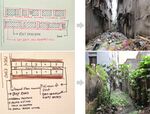
Perhaps, the scarcity of land area is precisely what prompts us in the first place to demarcate and secure our individual pieces of lands. However, the ultimate outcome of such a practice actually allows us to get far less value from these limited lands.The division of the land area into individual plots that are safeguarded with boundary walls eventually results in many problems: 1.The small amount of usable land area gets fragmented into even smaller pieces. 2.These spaces between our buildings and boundary walls can serve merely as setback spaces. With a boundary wall as a backdrop, they remain far from being welcoming. Thus these setback spaces are often left untended. 3.This consequently turns them into dirty, damp, dark & unhealthy leftover spaces. Eventually, it can even become a space where everyone throws their garbage into. 4.The back-alleys that are found in some neighbourhoods seem to face similar consequences.
This segregation restricts the citizens from interacting with their neighbors, for the walls clearly create spaces that have introvert characteristics. Rather than opening up to one another, they limit the scope of interaction among neighbors. 1.So, most of the people actually have to spend their leisure times inside their homes. On holidays, when the streets are empty children sometimes play on the street. The rest of the times however, the chunk of space on the roof serve as their playground. The traffic occupy the streets, and the spilled over shops & vendors occupy the footpaths on regular working days. The roofs also make up for the lack of common areas in the neighborhood to some extent, by catering to other age groups as well. But there is only so much the spaces on roofs can make up for. 2.Subsequently, the inhabitants end up living their lives in their demarcated bubbles. This in turn further limits the scope of community stewardship, and altogether deteriorates the social lives of the inhabitants. Thus, we fail to avail so many of the environmental, social and cultural benefits or values that we could otherwise get from even these limited amount of land areas.
Your references:
- ...https://www.google.com/maps/d/u/0/viewer?mid=14eYSjWmOc39l7-xhWcTj8ELixNU&hl=en&ll=23.765834000000012%2C90.363067&z=17
- ...http://www.thedailystar.net/op-ed/politics/goodbye-master-planning-hello-bottom-urbanism-208771
- ...http://www.thedailystar.net/drivers-economy/global-media-and-dhakas-urbanisation-1364854
Landscape Democracy Challenge 5: Saeid
- Religious landscape
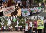
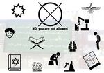
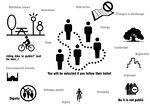
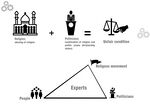
caption: After 1979's revelation in Iran new government started ruling the society based on religion. In other words the system change to a Islamic government, which means politic and religion were combined and it was the beginning of abusing religion especially by extremists. In this case, everything related to country and society got color of religion (either intentionally or unintentionally) and comes under religion's umbrella. Yet, as far as landscape is concerned the conditions get worse, while landscape is where people can gather in group, present themselves and be free in wide scale, which are not pleasant for government. So according to the new policies they started polarizing the society by making differences between men and women rights, thus by limiting women they make them more and more isolated. which not only affected health of society but also affected the unity of country.Therefore having less role and responsibility to do in society makes you to be more away from city life, landscape and so on, let alone women should struggle with other barriers such as way of wearing, not being accepted by others and etc. So it is obvious as the landscape is not for every single member of society in equal harmony there is no democracy. And removing such a taboo to reach a fair balance is a huge challenge.
In name of religion and with different excuses arrogating people's property or public free lands or landscape is a usual procedure in this regime. As examples I can draw your attention to the many hectors of gardens which were taken from people in Shiraz due to owner beliefs or direction, and then cutting down the trees and drying the field for constructing roads or buildings. or demolishing mountains as landscape identity of my city for building construction. Or constructing mosques, military campus and etc. in arrogated places.
limiting the facilities in open spaces to a group of people or specific genders due to variety of social conservation. Also due to lack of management and lack of power to standing against the religious movement losing unique value of landscape and identity of landscape is so high. so these kind of movements will not only stop promoting the existed values, but will avoid any maintaining projects. All these conditions get worse in cities with label of "Holy (religious) cities" such as Mashhad, Qom, Shiraz, Rey and so on.
Your references:
- ...
- ...
Assignment 5 - Your Democratic Change Process
- You can read more details about this assignment here
- After documenting and reflecting on your challenges you will continue jointly with one of these challenges and design a democratic change process
Your Democratic Change Process
- Rethinking plot compartmentalization
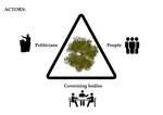
- Yourgroupname 2017 powermap.jpg
a power map identifying who is affected by the challenge and who is influencing it
- Yourgroupname 2017 change process (1).jpg
Look at the various methods and tools available and think how they can be applied creatively. Think about the needs of different stakeholder groups - you may need a methodical mix to address them all. Illustrate graphically how these methods/tools might be applied in a short, medium and long-term perspective.
- Yourgroupname 2017 scenario.jpg
a scenario illustrating how these tools can be applied within a short, medium and long term perspective involving the groups you want to address, this should include a process timeline
Reflection
- Evaluate in the group how far your ideas either built on the theoretical frame that has been introduced to you during this seminar or react to this by filling a potential gap (approx 150 words)
Theory vs change model:
- Our ideas built on rethinking about building setbacks spaces, this issue is crucial in restricting the forms of our city from becoming‘enabling forms’.
- The foundations of our participatory processes including citizen people,government housing,ministry policy makers,architects and engineer association and people in real state business.
- The process include of workshops,round tables and city games.Children also can be a part of this process as they have a very creative ideas and opinion abut their environment , so we thought about providing them by a good education , competition , art work and children city games.
Take home message:
- The idea was to participate people as much as possible by sharing thoughts and finding solutions because people can choose their future with the landscape.
Unresolved: -
Your references
- ....
- ....
- ....
- ....
