LED Online Seminar 2017 - Working Group 8
--> Back to working group overview
Dear working group members. This is your group page and you will be completing the template gradually as we move through the seminar. Good luck and enjoy your collaboration!
Assignment 1 - Reading and Synthesizing Core Terminology
- You can read more details about this assignment here
- Readings are accessible via the resources page
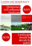
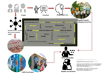
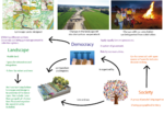
Step 1: Your Landscape Democracy Manifestoes
Step 2: Define your readings
- Please add your readings selection for the terminology exercise before April 12:
A: Landscape and Democracy - Mapping the Terrain
- Landscape Democracy Resolution (Nawar)
- Directive providing for public participation in respect of the drawing up of certain plans and programmes relating to the environment (Xinqi)*
- The European Landscape Convention (Jorge)
Landscape Concepts:
- Why is landscape beautiful?(Xinqi)
- Constructing Landscape Conceptions (Fatma)
B: Concepts of Participation
- Consensus Design (Jorge)
C: Community and Identity
- Welk Von Mossner, Alexa (2014): Cinematic Landscape (Alessandro)
- Spirn, Anne (2005): Restoring Mill Creek (Alessandro)
D: Designing
- Designing with Immigrants (Nawar)
- Places in the Making: How Placemaking Builds Places and Communities (Fatma)
E: Communicating a Vision
- Online decision making with loomio (Nawar)
- 'Reading the Landscape' by Simon Bell, EMU Tartu (Jorge)
Steps 3 and 4: Concepts Selection and definition
- Each group member selects three relevant concepts derived from his/her readings and synthesize them/publish them on the wiki by April 30, 2017
- Group members reflect within their groups and define their chosen concepts into a shared definition to be posted on the wiki by May 10, 2017.
- Other group members will be able to comment on the definitions until May 20, 2017
Concepts and definitions
Nawar H.Sabeeleish
- Concept 1 (Landscape Democracy Resolution {IFLA})
- IFLA believes that Landscape has to be shaped for the benefit of all.They believe in the need to form a governance system that responds effectively to the Urban Growth. They urged the Council of Europe, the European Union and all IFLA Europe Member States to form an all-encompassing vision with respect to social, political, environmental and that supports cultural policies to enhance the education,and to develop the landscapes with the locals, and to promote financial tools.
- Concept 2 (Loomio)
- Loomio is an open source software, built by a worker-owned cooperative social enterprise. It makes groups practicing effective, also inclusive decision-making without a mess of emails or meetings and can change organisational dynamics at a global scale. It has different features from polling, surveys, or social networking.
- Concept 3 (Designing with Immigrants(2015))
- Since immigration gives rise to global and local changes, and therefore it is very important to include immigrants in participatory design processes in order to create feelings of reciprocity and empathy to the city where they live, and this can be a key to trans-formative actions capable of producing social change.
Fatma Bekar
- Concept 1 Landscape Identity (Ana Kucan Constructing Landscape Conceptions)
- The world we live in, changes easily today. Does the landscape identity continue this trend?
- Concept 2 Virtous cycle (Places in the making MIT)
- For better places we have to nourish communities, for better communities we have to make good places.
- Concept 3 Collective understanding/acting (Places in the making MIT)
- A collective understanding can be fostered in a community based on a learned lesson and then can be an essential tool for collective action.
Alessandro Plazzi:
- Concept 1 (Cinematic Landscapes (Weik von Mossner, A.))
- The cinematic environment provides the space in which the action takes place. They are not only a feature of narrative film, but in real life cinematic landscape means to live in a time of climate change and rising sea levels. Citizens lives a life that is in many ways dictated by their environment.
- Concept 2 (Cinematic Landscapes (Weik von Mossner))
- "Slow violence" is a process of delayed environmental destruction that is dispersed across time and space.
- Concept 3 (Restoring Mill Creek (Whiston Spirn, A.))
- Planners too often concentrate on narrowly defined problems and fail to see the connections among seemingly related phenomena. Designers tend to focus on physical form and fail to account for the process that will continue to shape their project over time. Planners and designers maps are usually static snapshots of current conditions, narrowly framed.
Jorge Dzib:
- Concept 1 European landscape convention
The landscape is part of the land, as perceived by people or visitors, which evolves though time as a result of being acted upon by natural and human beings. One of the major motivations of the European Landscape Convention is the definition of “landscape quality objectives”, meaning for a specific landscape, the formulation by competent authorities of the aspirations of the public with the regard to the landscape features of their surroundings.
- Concept 2 Consensus design by Christopher Day
The definition of consensus is “general agreement, collective opinion”. Consensus design is about everybody getting if not what they wanted what after working together and listening to the whole situation, they have come to want. To get consensus however, two things must happen: we have to give up rigid past positions and move forward with flexibility and we have to transcend our own individual gain outlooks to look at what is best for all.
- Concept 3 “Reading the landscape” by Simon Bell
An important step before landscape planning or design is to understand the landscape, the process that formed it, and the processes for change. This include more than geographical information. Perception is important and visual and experiential aspects must be included.
Ji Xinqi:
- Concept 1 Directive providing for public participation in respect of the drawing up of certain plans and programmes relating to the environment
Effective public participation in the taking of decisions enables the public to express, and the decision-maker to take account of, opinions and concerns which may be relevant to those decisions, thereby increasing the accountability and transparency of the decision-making process and contributing to public awareness of environmental issues and support for the decisions taken.
- Concept 2 Why is landscape beautiful?
To identify a landscape as charming is insofar synonymous with the endeavor to "filter our" whatever we actually do see in the place visited, so as to be able to integrate the outcome in our preconceived, idealized image of the charming place.
- Concept 3 Why is landscape beautiful?
None of us is able to look at the landscape through anther person's eyes.
Step 5: Reflection
During this seminar, some of us were first time introduced to the broad meaning of Landscape, its expansive importance, and its linkage with democracy. As a group, we have developed key concepts about Landscape democracy which are listed as follows; Landscapes could be urban or rural and the spaces in between. Communities and landscapes affect each other. For strong communities we need to appreciate the landscape identity first. And after that, comes the need for making good places for the communities with the participatory design. Thus through the strong communities, a collective understanding can be enhanced and with the collective understanding a community can act collectively against the challenges. And this emphasizes that Landscape is a platform for democracy and that people are the heart of this platform. These democratic Values play a huge role in landscapes, and these values add new important dimensions to landscape definition; such as the interaction between society and landscapes, participation, and development. Landscape is not about trees and aesthetics; it should be shaped for the benefit of all, involve collaboration, participation and respecting the communities whom landscapes are designed for.We all do believe that we had a valuable seminar during this semester, and we are already empowered and will go back home to contribute to the already existing wider knowledge on landscape with fresh ideas, insights and perspectives that will make better landscapes and improve the existing for all citizens, So we would like to thank you for this astonishing opportunity.
Step 6: Revised manifestoes
- please look again at your initial manifestoes and update them with any new aspects/prespectives you have taken up during this seminar
- Updatedmanifesto3.jpg
xy's updated manifesto
- Updatedmanifesto4.jpg
xy's updated manifesto
- Updatedmanifesto5.jpg
xy's updated manifesto
Assignment 2 - Your Landscape Symbols
- You can read more details about this assignment here
Nawar H.Sabeeleish's Symbols
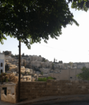
This picture was taken in Jabal Amman in Jordan (31°57'03.1"N 35°55'39.2"E). It symbolizes the Urban sprawl in correspondence to the culture.The habitat clustered units reflect the social intimacy of a local Ammani society,simultaneously the openings within each building maintain a level of privacy and territoriality which originates from the Arab and the Islamic traditions, and since this was our faculty (Architecture) view it was perceived also as an educational symbol.
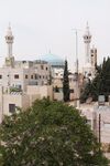
This picture was taken in Jabal Alweibdeh in Amman (31°57'35.3"N 35°54'41.6"E ). From my perspective, this picture has a religious and a socio-cultural symbolic meaning; the religious symbols can be seen in the Christian cross on a church and the crescent on the minaret of a Muslim mosque. The socio-cultural meaning can be perceived by the viewer according to the religious symbolism appearance; in which it emphasizes on the peaceful coexistence between the two religions in Jordan.
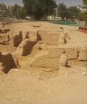
This is the World's oldest purpose-built Christian church is in Aqaba, Jordan. Built in 293, and pre-dates the Church of the Holy Sepulchre, in Jerusalem, Palestine and the Church of the Nativity in Bethlehem. During the excavations which were held by Prof.Dr.Thomas Parker(NCSU) many evidences of the succession of civilizations in the area have been revealed, increasing the importance of the site in the eyes of the responsible governments after having it abandoned and covered with sand for more than 150 years, now a new Archaeological conservation plan is in process (by ASEZA) to promote it as a historical site with respect to educational, religious, cultural and social aspects. And i would like to inform you that this was my graduation project thesis, and i am contributing as well in the conservation plan and design.(29°32'01.3"N 34°59'57.3"E)
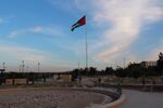
For me this picture is where a lot of symbolism appear. This is a Jordanian flag, located near a public park, which has a political, seignior, and power symbol to the visitors and since it rises 127 meter on a hill,it can be seen almost from everywhere in Amman, so this symbolism is spread all aroud the city. The Flag itself has different symbolic meanings; and this can be noticed with the different colors used in the Flag's design, these are the Pan-Arab Colors, representing the Abbasid (black band), Umayyad (white band), and Fatimid (green band) caliphates. The red chevron is for the Hashemite dynasty, and the Arab Revolt. (31°58'13.9"N 35°56'08.2"E)
- Symbol yourname photovoice5
add a caption (one paragraph max) description of the symbolism, interpretation, as well as geo-location
Jorge Dzib Landscape Symbols
This sculpture of crucified Jesus Christ is a religious and symbolic element located in the Bavarian country side. It is an ornamental element for the landscape and a remainder of the catholic faith of the local people. It is located in a crossroad where it can be seen by cars of people walking. (N 48°33’37.26” E 11°46’33.97”)
The catholic church of St. John the is located in the middle of the Hallertau in the municipality Haslach (200 inhabitants). It was built in 1875, instead of the old church, as a neo-gothic brick building with a polygonal choir. The church is surrounded by a small ecclesiastical cemetery with 35 tombs. This is the more important symbolic element of the area and have big importance for the identity and memory of the community. (N 48°33’33.44” E 11°46’43.61”)
The Hallertau in Bavaria is the largest single hop-growing region in the world with over 14,000 hectares and more than 1,300 hop farms. This structures are a symbol of the history and the economical activity of the area. In current times less people form the community work in hop production and is actually a place for seasonal work. (N 48°33’37.64” E 11°46’40.61”)
- Symbol yourname photovoice5
add a caption (one paragraph max) description of the symbolism, interpretation, as well as geo-location
Landscape Symbols Fatma Bekar
This photo belongs to the Roma bostan which was designed near the Cihangir stairs that is often visited by the young people. The site with the Roma park beneath are the last green areas of Cihangir and always under threat. A group of people first started in 2013 and then invited people to desing the Roma bostan with the permaculture design principles. 41°01'44.3"N,28°59'00.1"E
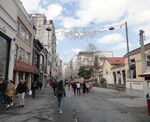
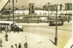
Taksim Square is one of the most important centers of İstanbul that is always visited by torists and citizens. On the west İstiklal Street is a famous shopping centre with having a nostalgic tram running from Taksim to Tunnel. Taksim Square is where Monument of the Republic, Atatürk Cultural Center, the old water resorvoir and Taksim Gezi park meet. Monument of the Republic was built in 1928, commemorating the Turkish Republic formation. The water resorvoir which gives name to Taksim was commissioned by the Ottoman Sultan I. Mahmud. AKM Atatürk Cultural Center is one of the important buildings of modern Turkish architecture. Taksim Gezi Park is the last green area of Taksim Square. 41°2′13″N,28°59′9″E
- Symbol yourname photovoice5
add a caption (one paragraph max) description of the symbolism, interpretation, as well as geo-location
Landscape Symbols Alessandro Plazzi
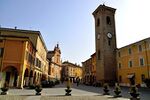
This is "Piazza Nuova" in Bagnacavallo. It could be considered as a prototype of a modern mall, here there were butcher shop, olive oil shop and the fish market. Today Piazza Nuova hosts a restaurant and a pub, it is highly frequented during the spring and summer season. Sometimes there are also shows and concerts.
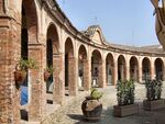
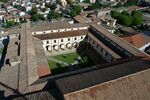
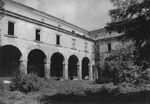
This is the Ancient S.Francis Convent in Bagnacavallo, located in the town centre. It was founded in 1450 and it is a very big structure related to his surroundings. Today after a big intervention of restoration is in a semi-abandoned status. In the past it hosted a hostel and a restaurant, today is open for only short periods and host some exhibitions and discussions.
- Symbol yourname photovoice4
add a caption (one paragraph max) description of the symbolism, interpretation, as well as geo-location
Landscape Symbols Ji Xinqi
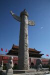
This photo was taken in Tiananmen Square,Beijing,China. This square is the most important square for Chinese people. It represents the political and cultural center. In the picture, we can see there is sculpture with dragon symbol. In the ancient time, emperors were believed they are the son of the dragon. They were decided to be emperors when they born. In that time, people didn’t have democracy. But from ancient times to the present, we still use it our nation symbol.
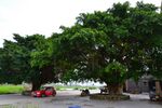
This photo was taken in Xinchuliao Village, Shantou, Guangdong Province,China. In most of the village, there are different kind of big trees in the important place of the village. Some are in the entance of the village. Some are in the center of the village. Children will play fun here, and the old will play chess here. And they are the democracy center of the village. Villagers discuss and decide important things here.
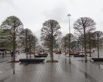
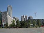
This photo was taken in Flower City Square, Guangzhou, Guangdong Province,China. On the left side of the picture, it is the Guangzhou Library. On the right side, it is the Guangdong Museum. Those buildings are the public fuction buildings. The government place this square in the city axis. Government hope people can spend their time in this square. But people do not like this square especially in the summer time. Guangzhou is in the subtropical area.This kind of square without tree shapes, people hope to pass it as fast as they can. It contrarys to democracy.
- Symbol yourname photovoice4
add a caption (one paragraph max) description of the symbolism, interpretation, as well as geo-location
- Symbol yourname photovoice5
add a caption (one paragraph max) description of the symbolism, interpretation, as well as geo-location
Assignment 3 - Role Play on Landscape Democracy "movers and shakers"
- You can read more details about this assignment here
Assignment 4 - Your Landscape Democracy Challenge
- You can read more details about this assignment here
- Each group member will specify a landscape democracy challenge in his/her environment
Landscape Democracy Challenge 1: Nawar H.Sabeeleish
- The Disrespect of Nature
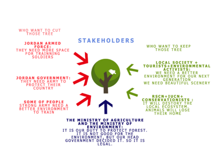
The conflict was based on the fact that this forest represents an integrated ecosystem that houses over 100 plant species — 13 per cent listed as rare, 4 per cent as locally or internationally threatened and 13 per cent as holding medicinal value, according to ecologists at the Royal Society for the Conservation of Nature (RSCN) and it promotes Eco-Tourism in the area and this has sparked a controversy among Environmentalists, activists and the local community and the local tourists and described it as a flagrant violation of the laws.
The key Actors are the Ministry of Environment(MoE) for approving such decision, the Jordan Armed Forces for choosing the one one percent of Jordan that is still forested. On the other hand The Royal Society for the Conservation of Nature(RSCN), The International Union for Conservation of Nature (IUCN), the Conservationists and environment activists and the locals were they key actors to stop the cut down.
Your references:
- http://www.rscn.org.jo/content/conservationists-relaunch-campaign-protect-bergesh-trees
- http://www.jordantimes.com/news/local/no-more-bergesh-trees-will-be-cut-military-academy-%E2%80%94-agriculture-minister
- http://www.thenational.ae/news/world/middle-east/conservationists-battle-jordan-government-over-plan-to-axe-2-200-trees
- https://www.iucn.org/id/node/8625
Landscape Democracy Challenge 2
- Give a title to your challenge
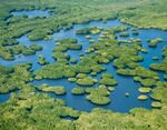
The mangrove is a dense, tree or shrub-like formation of woody vegetation of 1 to 30 meters in height. It is composed of one or more species of mangrove and contains few herbaceous or climbing species. Coasral wetlands, especially mangroves, provide a wide variety of environmental services: they are sites of nourishment, refuge and growth of juvenile crustacea and fish, and as such they sustain a large part of fishery production, but are also used as a fuel (firewood), have a high aesthetic and recreational value, act as a natural flood control mechanism and as barriers against hurricanes and saline intrusion, control erosion and protects the coasts.
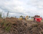
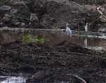
Soldiers guarded and anti-riot elements surrounded the zone, as 150 truks and cranes cleared the Tajamar mangrove without saving flora and fauna. All this was confirmed by Aracely Dominguez, president of the Mayab Ecologist Group (GEMA, Grupo Ecologista del Mayab), who witnessed what happened. “As Mexicans, it hurt us to witness that instead of using the public force against criminals, they are using it against citizens and against the environment. It is truly embarrassing to see that the government is doing this, to see that it does not have neither political nor social sensitivity”, complained Domíngez in an interview for Mongabay. A Catholic Chorch basilica –the biggest in Latin America-, shopping malls, offices and more than 3,000 homes plan to be built in the area. This puts the survival of crocodiles, snakes, herons and plant species under risk. One of this species is the white mangrove, which is listed as a threatened species under Mexican law MOM-059.
According to an announcement by Quintana Roo State governor, Roberto Borge, the National Trust for Tourism Development (Fonatur), which is charge of the project, has had since 2005 the necessary licenses for tourist development in the area. This mean that the construction work were carried out according to an agreement, but without having appropriately rescued the animals and plants, as required by law. However, Dominguez has accused Fonatur of committing a seious crime – giving false information to the environmental authorities, falling to comply with conditions laid down for the conservation of flora and fauna, and working alongside developers in the destruction of a mangrove. According to witnesses, two days after the mangrove clearing started, several people entered and watched living animals such as crocodiles, boas, eagles, herons, frogs, squirrels and iguanas as they fled the area. At that moment, truks arrived “expecting to refill the mangrove and bury those animals alive”, but Dominguez and other activist stopped them.
Your references:
- http://www.biodiversidad.gob.mx/v_ingles/ecosystems/mangroves/mangroves.html
- http://voices.nationalgeographic.com/files/2015/02/09_JaimeRojo_101006_5454-watermarked.jpg
- https://news.mongabay.com/2016/02/a-mangrove-in-cancun-that-was-home-to-many-crocodiles-boas-eagles-herons-frogs-squirrels-and-iguanas-is-destroyed/
- http://www.eluniversal.com.mx/articulo/nacion/sociedad/2016/02/8/calderon-puso-lapida-manglar-de-tajamar
Landscape Democracy Challenge 3
- Give a title to your challenge
A mosque is being built to the Taksim Square. It is down the square on the edge. It is not so much visible from the square because of the buildings and the topology of the site. It is debatable in a place like Taksim Square's identity. The question is with the ongoing projects what will be the Taksim Square image?
In old photos of Taksim Square we see people dressed up in most stylish manner to take promenade. Taksim was a place of cultural and entertainment before and now. Normally people would come here for cultural activities, theathers, the prestigious school, high quality cultural cafes and the specific bookstores. Today students don't want to go Taksim Square as before. The daily experience of Taksim Square is lessening. People starting to loose their sense of belonging. Day by day the cultural places are disappearing in Taksim. Socio cultural context is changing. Shops are being closed partly because of the terrorist attack. Now mostly tourists from İslamic countries are visiting Taksim.
- Taksim Squaree.jpg
The actors are central government, people of all ages, all cultures and the land speculators.
Your references:
- http://www.sozcu.com.tr/2016/gundem/gezi-parki-projesi-yeniden-gundemde-1282521/
- http://www.istanbulium.net/2012/02/taksim-meydan-ve-cevresi.html
Landscape Democracy Challenge 4 Ji Xinqi
- Ugly face in city
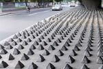
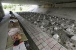
caption: This picture is taken in Guangzhou,China. The government built cement cones under highway bridge to drive out homeless people. The government said it is built up for preventing illegal parking.But I think it shows the ugly face of city without humanity.Pictures of the lethal 20cm high barbs in Guangzhou have sparked online outrage with citizens angry that authorities are trying to 'hide' the homelessness problem. But the true purpose of the spikes has not been revealed.This is because the area's Bureau of City Management, Bureau of Transportation and Bureau of Construction have all denied responsibility for the work.
caption: Although the conflict is obvious. But the government make the decision without any announce. Regarding to the discussion about building cement cones in Weibo, the management department of the city in Guangzhou responded yesterday that they did not make any cement cones to discourage the homeless to sleep under the bridge.
Your references:
- http://www.chinahush.com/2012/07/05/building-cement-cones-under-highway-bridge-to-drive-out-homeless/
- http://www.dailymail.co.uk/news/article-2168175/Are-lethal-concrete-spikes-stop-beggars-sleeping-city-bridges-REALLY-Chinas-best-option-stop-homeless-problem.html
Landscape Democracy Challenge 5 Alessandro Plazzi
- The value of cultural heritage
The Convent has a long history, the construction started on XII century. After the ecclesiastic use it went under the management of the municipality and performed civil functions such as the town hall, elementary school and police district. During WWII the Ancient Convent of S. Francis was heavily bombed and it was unable to perform these functions in safe conditions.
In 2000 the municipality of Bagnacavallo decided to operate a big restoration intervention, and today it is possible to visit it but it doesn't have a specific function so, we can consider it as an indecisive space. In the recent past it was a hostel, a restaurant and a showroom gallery for temporary exhibitions. Now, all these activities have been closed.
Your references:
- «La Fabbrica della Città» – Comune di Bagnacavallo – Edit Faenza, 2013
- http://www.academia.edu/1955225/Giuseppe_Grossi_Bruno_Minardi._Nostalgia_urbana_il_convento_di_S.Francesco_a_Bagnacavallo
- http://www.comune.bagnacavallo.ra.it/
- http://www.labassaromagna.it/
- http://www.lugonotizie.it/articoli/2017/04/15/bagnacavallo-riapre-il-convento-di-san-francesco-diventato-albergo-gestito-da-due-35enni.html
Assignment 5 - Your Democratic Change Process
- You can read more details about this assignment here
- After documenting and reflecting on your challenges you will continue jointly with one of these challenges and design a democratic change process
Your Democratic Change Process
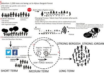
- No Cut of Bergesh Forest
Look at the various methods and tools available and think how they can be applied creatively. Think about the needs of different stakeholder groups - you may need a methodical mix to address them all. Illustrate graphically how these methods/tools might be applied in a short, medium and long-term perspective.
Reflection
- The case study oft he Ailoun is an example on how government institutions don’t represent the interests of the population and ecology. The project of the Academy will bring a huge impact in the small reserve of forests of Jordan.
It is clear that the ministry of agriculture and the ministry of environment didn’t fulfill their responsibility in regulating this kind of decisions. In a global view this is a waste of budget since the government is investing in this institutions with money paid by the population that doesn’t work. I believe the awareness in the landscape importance will grow in the next years. For real solutions we need new frameworks for participation, education and design.
Your references
- http://www.rscn.org.jo/content/conservationists-relaunch-campaign-protect-bergesh-trees
- http://goumbook.com/activists-protest-against-bergesh-forest-project/
- http://www.rscn.org.jo/content/no-more-bergesh-trees-will-be-cut-military-academy-%E2%80%94-agriculture-minister
- http://jordantimes.com/news/local/regulation-penalising-cutting-endangered-trees-comes-effect
- http://www.thenational.ae/news/world/middle-east/conservationists-battle-jordan-government-over-plan-to-axe-2-200-trees
- http://nais-jordan.gov.jo/Pages/NewsDetails.aspx?lang=EN&Cat=0&I=3001&DId=10000&CId=0&CMSId=397&id=2399343
- http://apnature.org/en/content/save-bergesh-forests
- http://www.alarabiya.net/views/2011/01/18/133947.html
- http://en.ammonnews.net/article.aspx?articleno=25591


