File:Map plus CARP.jpg
Jump to navigation
Jump to search


Size of this preview: 800 × 488 pixels. Other resolution: 855 × 522 pixels.
Original file (855 × 522 pixels, file size: 75 KB, MIME type: image/jpeg)
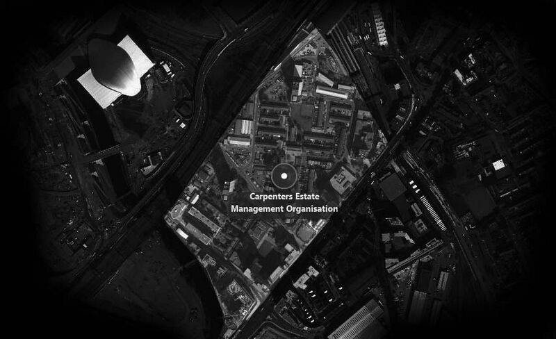
The map is showing the boundary of Carpenters estate, which borders the Olympic Site and it has been included in the Local Plan of the Olympic Legacy; natural boundaries are river Lee, Stratford rail station, Stratford International
File history
Click on a date/time to view the file as it appeared at that time.
| Date/Time | Thumbnail | Dimensions | User | Comment | |
|---|---|---|---|---|---|
| current | 10:52, 12 May 2016 |  | 855 × 522 (75 KB) | Danielae (talk | contribs) | The map is showing the boundary of Carpenters estate, which borders the Olympic Site and it has been included in the Local Plan of the Olympic Legacy; natural boundaries are river Lee, Stratford rail station, Stratford International |
You cannot overwrite this file.
File usage
The following page uses this file: