File:Alin Cezar Vintila Concept map.png
Original file (4,000 × 2,400 pixels, file size: 508 KB, MIME type: image/png)
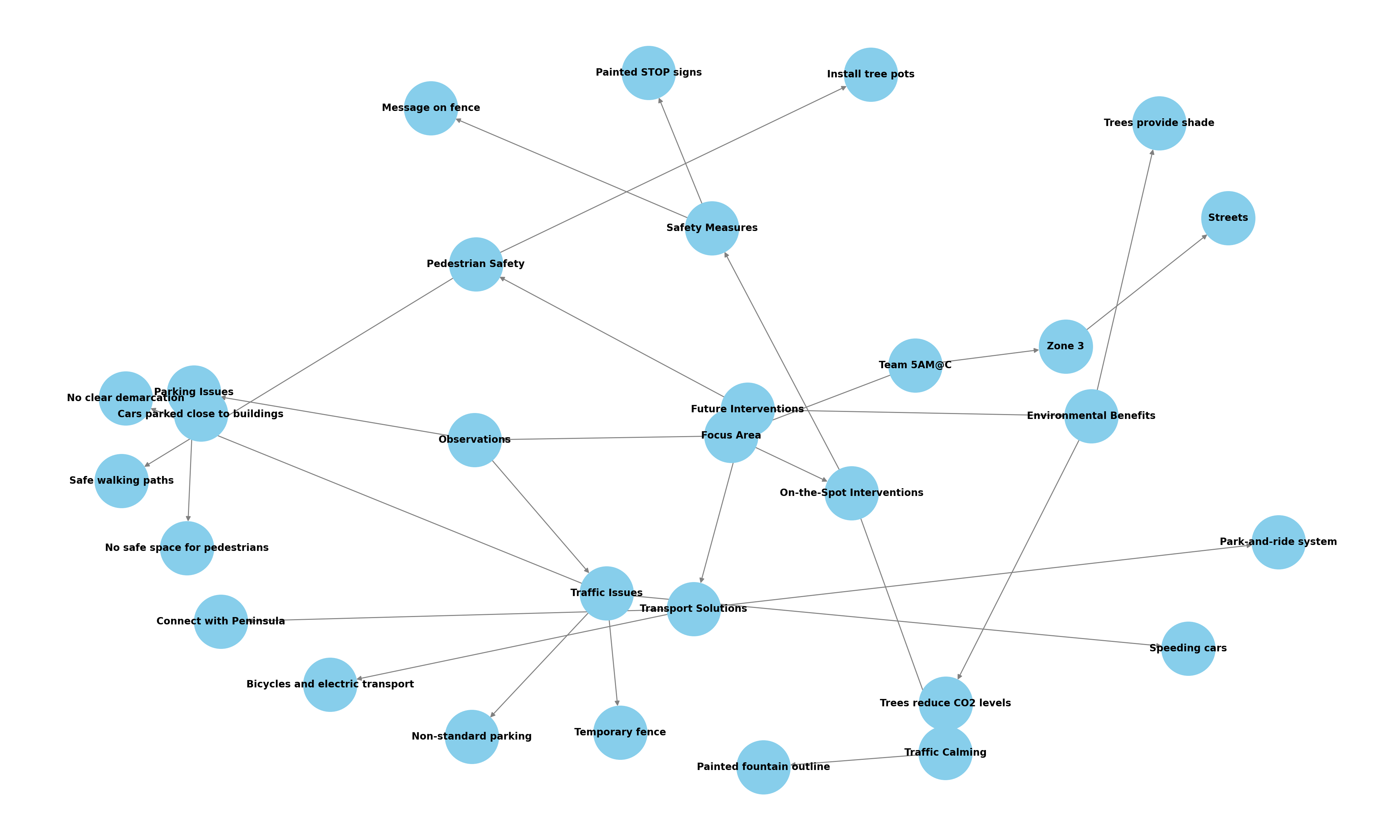
Peninsula Constanta - area between the following streets: Remus Opreanu, Revoluția din 22 Decembrie 1989, 9 Mai, Arhiepiscopiei, pr. dr. Ion Cantacuzino, and Cristea Georgescu After inspecting the entire zone, I focused on the intersection of Remus Opreanu and Revoluția din 22 Decembrie 1989, which has the geometry and characteristics of a town square. Current situation: ● Cars were parked close to the buildings, leaving no space for pedestrians to walk safely. ● The speed of the cars often exceeded the limit. ● There was no clear demarcation between the walking space and the driving/parking space. ● Drivers often made their own rules, parking parallel or at an angle. ● A temporary fence along the Direcția Agricolă encroached on pedestrian space.
Future Interventions: ● Installing a line of tree pots on both sides of Remus Opreanu and Revoluția din 22 Decembrie 1989 to create a safe walking path between the trees and the buildings. ● The trees will provide shade for both pedestrians and buildings and help reduce CO2 levels in the area. ● Implementing a park-and-ride system using the three parking spaces adjacent to the Peninsula, and providing bicycles and electric public transport to connect the parking areas with the Peninsula.
File history
Click on a date/time to view the file as it appeared at that time.
| Date/Time | Thumbnail | Dimensions | User | Comment | |
|---|---|---|---|---|---|
| current | 10:35, 2 July 2024 | | 4,000 × 2,400 (508 KB) | Ola2024 Team10 (talk | contribs) |
You cannot overwrite this file.
File usage
The following page uses this file: